Tripciak goes to the Sudetes - the Crown of Polish Mountains
At the end of September, the academic year is approaching inexorably. After our trip this year, I was a little unsatisfied, so together with Dominika we decided to take a few days off at work and set off ... There were a lot of plans ... visit one of the European capitals or other more interesting places. We wandered for a few days, where to go here, what to do, so many things to do, but a little time ... This turned on the lamp above the head like in a cartoon. Hola, hola, we have the Crown of Polish Mountains to be finished. Without thinking much, we packed our trekking equipment into the bus and set off again with our beloved Tripciak in the Sudetes.
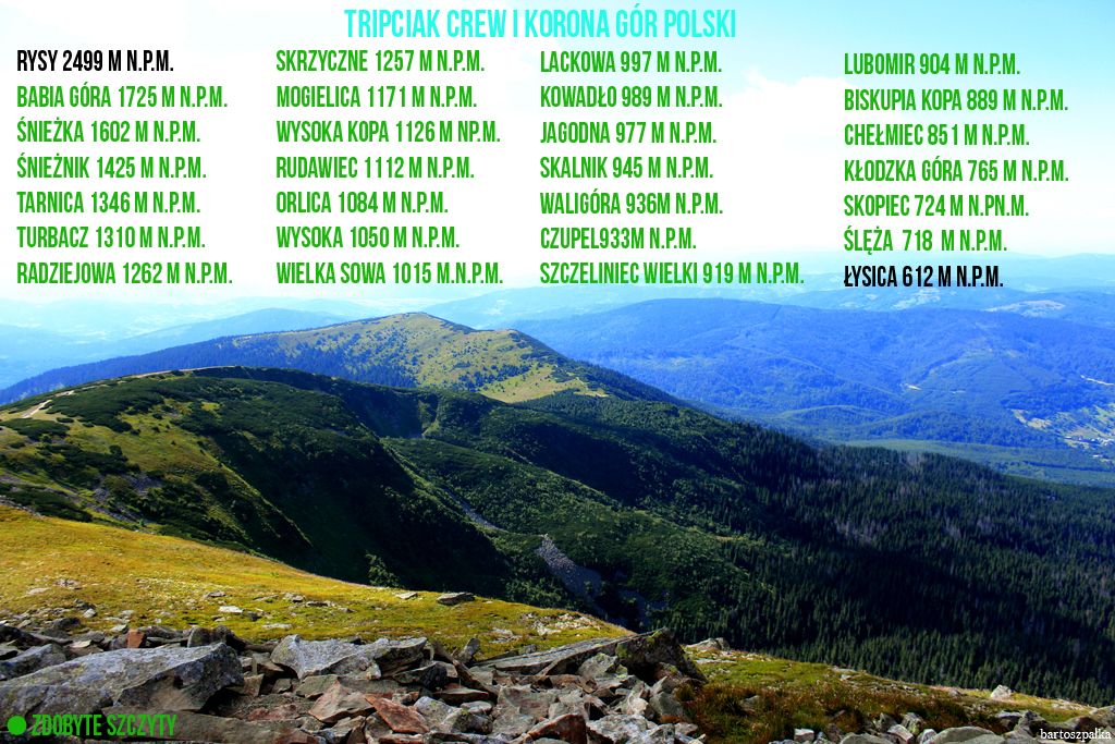
What is this Crown of Polish Mountains? KGP consists of twenty-eight peaks, which are the highest points of each of the twenty-eight mountain ranges in Poland. It was approved in 1997 at a special meeting convened by the editors of "Know your country".
We left on Thursday evening in order not to waste time in the morning on unnecessary several hours' journey, but to go straight to the mountains. After all, we only have 5 days to reach 15 peaks in the Sudetes range.
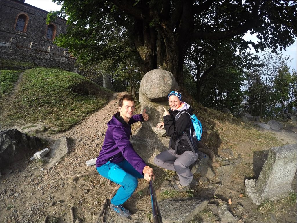
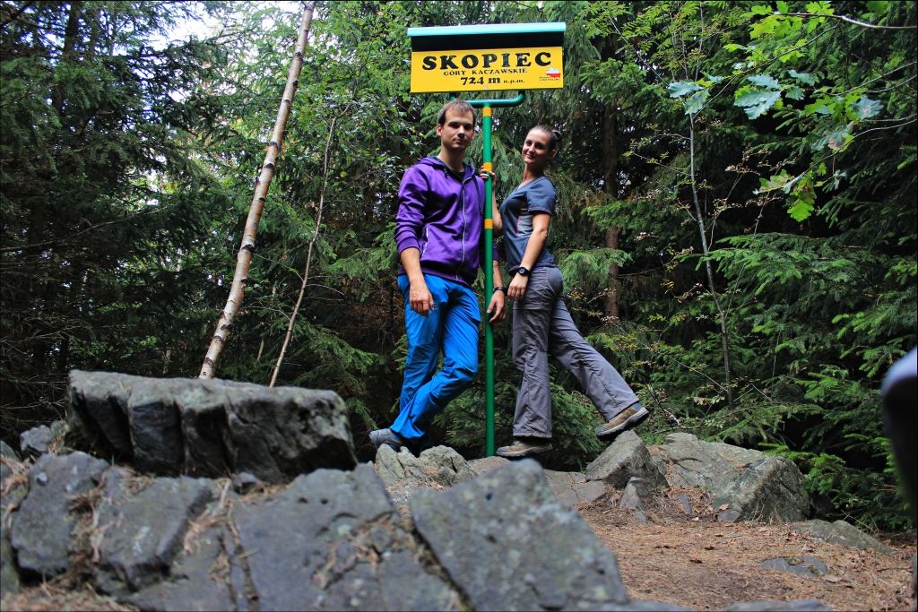
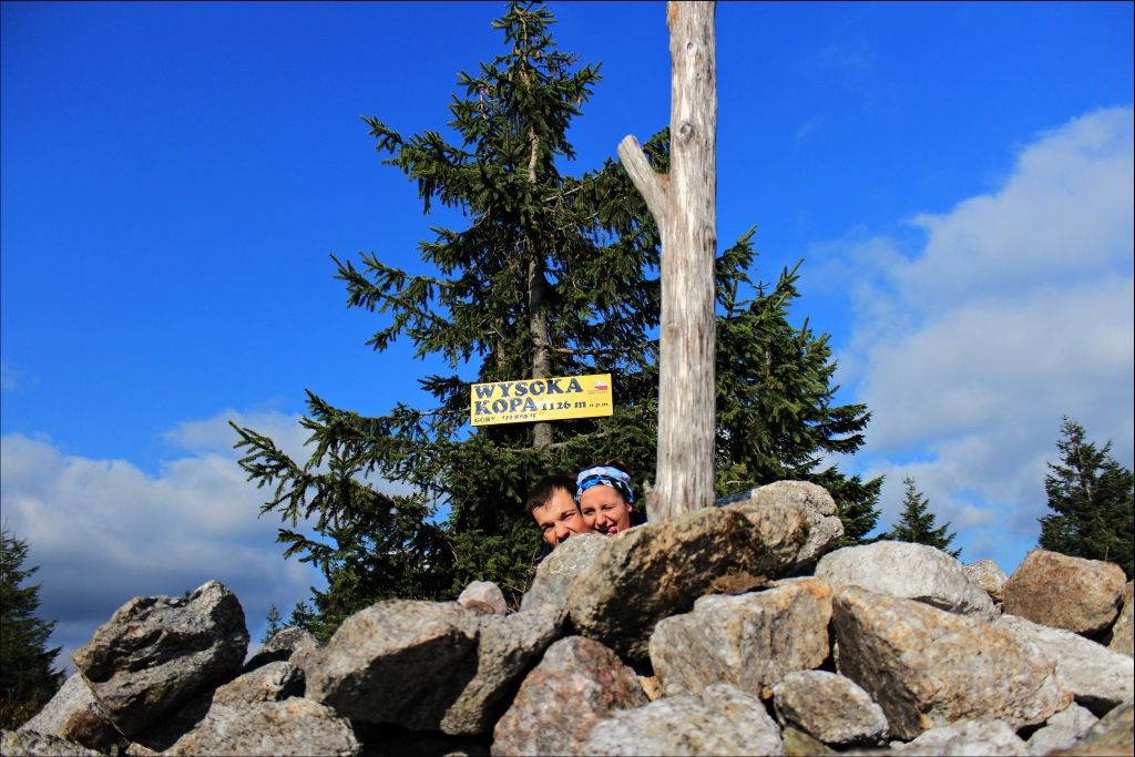
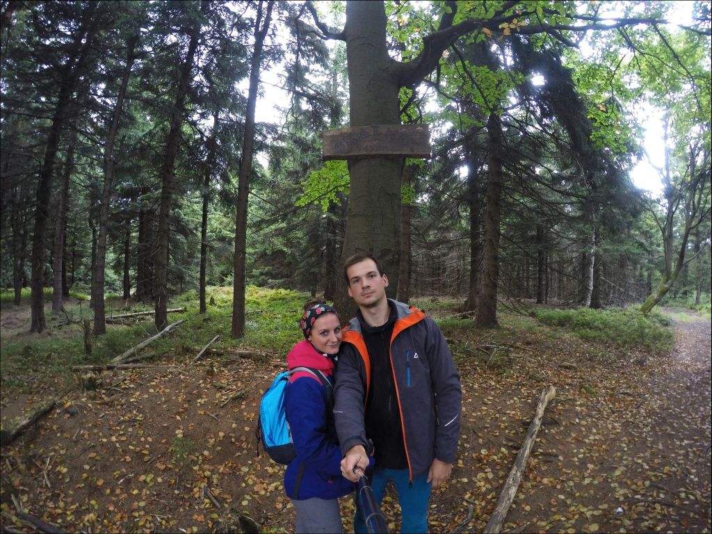
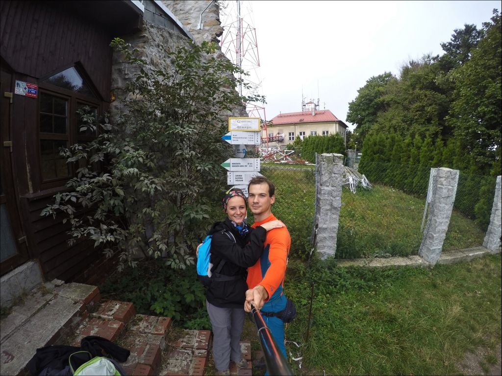
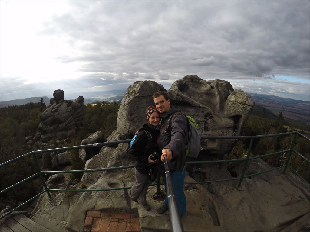
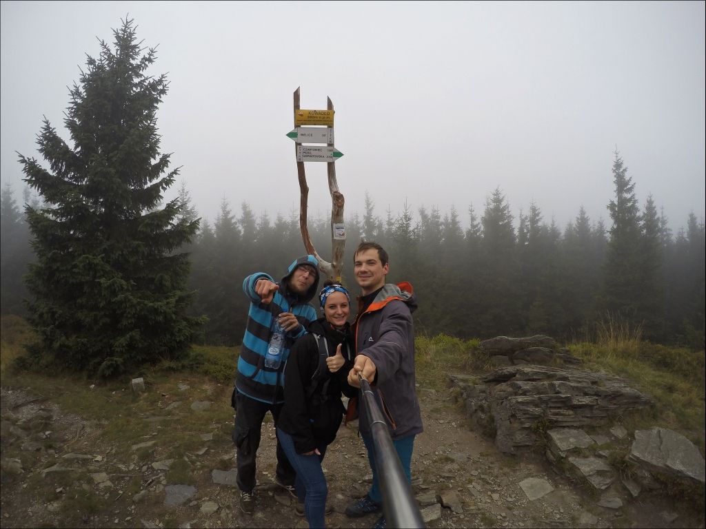
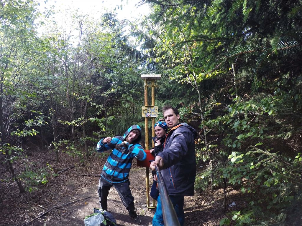
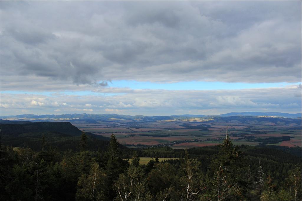
After a few hours of driving, we leave the motorway and head towards Świdnica, from a distance you can see the outline of a lonely mountain with a huge 136-meter mast, which belongs to a telecommunications station, located at the top of the mountain, illuminated in red. Finally, we reach the Tąpadła Pass in the Ślęża Massif, where we spend the night. We got up at 6am, it was a bit chilly but someone had to feed us. I prepared a quick travel breakfast, i.e. sausages with ketchup :) and after 7 we were already on the trail. We have several hiking trails to choose from. We chose the yellow one, which led to the top by a hard, paved road. On the way, we pass a tourist shelter. Rest is not necessary, so we continue our march. On the way, we pass an educational path with boards with descriptions of plants and local animals. Dominika keeps wondering why they put a cartoon bear there, since they are not there ... After 40 minutes, we reach the top, where there is a church, PTTK shelter, a telecommunications station and an inactive observation tower. We can't find the sign on the top anywhere, so we went to explore the area a bit. We went to the now closed lookout tower. The hatch was open, the problem was that it was 3 meters above the ground ... Of course, using the handrail, I had an idea how to climb there, but a later descent, i.e. a jump from 3 meters onto hard concrete, would not be a pleasant feeling, so I let go goofing around and go to the church. Inside, a nice lady opened an underground for us, where there are archaeological excavations and a piece of the ruins of the former castle. At the exit, we throw a brick to save this church and go to the shelter for a stamp for KGP books, these are open from 9:00 am, so we have to wait almost half an hour. In the meantime, we learn that this bear comes from the cult of ancient pagan rituals and stone sculptures that were found on the top, which is why it became a symbol of Sleza. We lived to see the opening of the shelter, we stamped the highest peak of the Ślęża Massif (Przedgórze Sudeckie) as conquered and we go down to go to the village of Komarno in order to conquer Skopiec. There is no trail leading to Skopiec, so you have to figure out how to get there. Tripi took us along the yellow trail that runs from Komarno to the place where the asphalt ends, we leave the car there, and along the gravel path behind the yellow trail, we continue our journey. After about 2 minutes of walking, we reach a characteristic tree on which shoes are nailed. At this point, we turn right diagonally and continue through the meadow, after a while in the distance you can see the outline of a plate made by one of the enthusiasts of mountain hiking with the direction of the road to Skopiec. After a while the road joins the blue trail leading to the neighboring peak - Baraniec. Coming out of the forest, when we start with a panorama of the nearby villages, and on the right we have the masts at the top of Barańca, we turn strongly to the left - it is impossible not to notice the well-trodden path through the forest, in addition, on the tree we can find a small piece of paper with an arrow pointing to the mound . Walking through the forest on a tree, we see a yellow arrow pointing the way to the top. The whole journey took us 12 minutes! Probably the fastest peak we have reached :) We tick the Kaczawskie Mountains from the list. In 8 minutes we return to the car and drive to conquer the third and most advanced KGP peak to the west - Wysoka Kopa.
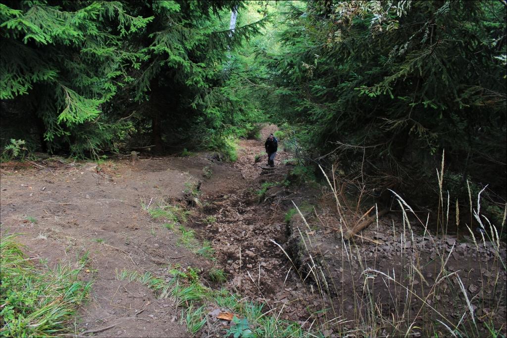
We start the attack on the highest peak of the Jizera Mountains from Rozdroże Izerskie. We leave the bus at one of the two huge parking lots and start our journey along the green trail. The road initially runs through a well-compacted fire road, then after about 15 minutes of walking, it turns right at a 90-degree angle and a rather steep climb begins. I can get tired. Fortunately, this is the only such approach during the entire hike. Then, the trail runs through a beautiful green forest, the journey is made even more pleasant by beautiful smells and chirping birds. At the crossroads, we turn right and continue along the red trail. Sometimes on the right and on the left there are various rock formations, from which there is a view of the surroundings and the fields in the distance. On the way, we pass the closed Stanisław quartz mine, where the trail then runs about 1.5 km along an asphalt road and then turns right into the forest. There is also no trail leading to Wysokie Kopa, so you have to be on your own. We find ourselves on the map and try to reach the top using characteristic points. In the distance you can hear a flowing stream that you have to cross. There used to be a footbridge there, but unfortunately it is no longer there. We reach the top with a trodden path in the grass, unfortunately we can't see anything, we wander around for a while and finally we manage to find a sign placed on one of the trees. We shoot a souvenir photo and go down to the red trail again, but on a different route, which we found on the map. We reach the tourist shelter. There is a marker on it an arrow pointing to the right with the annotation "Wysoka Kopa 500m". This is in case someone was walking from the other side of the trail or was planning a summit attack along the road from behind the shelter. We liked the shelter very much, inside, apart from wooden benches and tables, there were 2 large places where you could sleep, ultimately they will probably serve as a shelf for backpacks during large trips. Ajajaj a pity that we didn't take our sleeping bags with us because we would probably spend the night there. We go back the same way. We decided to spend the night in the parking lot, we made a barbecue and heated a pot of water on the stove to wash ourselves a bit. It got dark quite quickly, we analyzed the map and it turned out that we have to spend almost 7 hours for a snowball according to the map !. We are supposed to do 3 peaks a day, and here is such a trick. A little after 20 we were already in the bus and we were resting before the next attack on the summit.
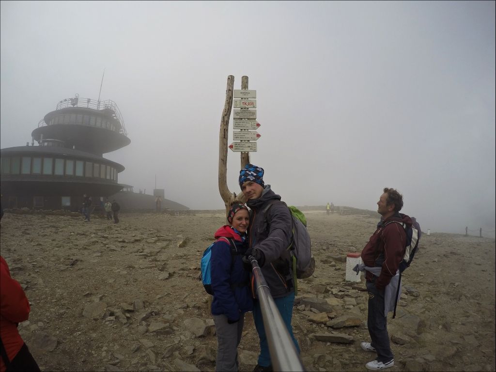
We were supposed to get up at 6:00, but the cold weather and the gray weather outside effectively discouraged us, the bed turned out to be stronger ... We got up before 9:00. What a delay. We ate breakfast and went to Karpacz. We left the car on the ski slope due to the lack of free parking spaces. I went to a nearby bar to find out if I could stand there. The nice lady gave me detailed information that the city did not apply for a sign of a ban on entry, the city guard cannot give a ticket and people park there, but on their own responsibility and warned us that we have to be careful when leaving because no one cares about the driveway for several passenger cars have already lost the refills of the bumper or the oil pan, I took a look at these inequalities ... after our trip through Albania, we are not afraid of any pits. We left the trail at 12:00, theoretically we were supposed to be on our way back from Śnieżka at this time. Too bad, we will only do one summit today. The trail markers show the 3.5-hour time to climb to the top. Out of curiosity, I start the stopwatch and off we go. The beginning of the trek was very pleasant. We get to the shelter on Łomniczka River, where we eat a bar and warm ourselves with warm tea from a thermos, people have gathered a lot. The road turns into a stone paved road, and after a while it turns into a stone staircase. The roads we hate in National Parks. If we wanted to go up the stairs, we would go to the block: P Well, we have to suffer and go on. The wind intensifies, which after a while turns into a gale. Fortunately, the views compensate for everything. On the way we pass people in short sleeves, without hats, in sneakers and boots ... the poor things are shaking from the cold. Well, not everyone knows that when it is 20 degrees at the bottom, it can be much colder at the top and it is worth putting a sweatshirt and a hat or even a scarf in a backpack. On the way, we pass the symbolic Mountain Victims Cemetery above which there is a large cross with the inscription OFIRAOM MOUNTAINS. After a while we reach the Dom Śląski shelter, people more than in the shopping mall. After all, it's Sunday, and you can almost get to this place by a queue ... That's probably why it's so crowded. We are left with the last approach to defeat people, so many people go step by step, goose by conviction ... In the background, every now and then you can only hear the screams of parents at their children "Wear this hat" "Put on these gloves" "Come here because if it pours you in right away "The magic of mountain hiking breaks away right away. The summit is covered with clouds, there are no views. We take a photo on the Polish and Czech side, thanks to which we reach the highest peak of the Czech Republic, which belongs to the Crown of Europe. I would forget to add, instead of 3.5 hours we climbed to the top in 1h 35min. It took us even less to descend, so despite a delay of several hours, we managed to move our butts to the next place, i.e. to Czarnów, to reach the highest peak of the Rudawy Janowickie.
We leave the car in the parking lot next to the garbage cans. The parking lot can accommodate up to 3 cars. We follow the blue trail to Mała Osta, the road goes through a larch forest with pine needles covering the path, creating a soft and pleasant layer, the road is very pleasant, but you have to be careful not to get lost. The forest is quite dense, and the path sometimes divides in three directions ... mainly due to fallen trees, but sooner or later they all merge in one place. The markings sometimes blend in with the background. However, it is enough to stop for a moment, strain your eyes, and you can move on. We reach Mała Ostra, where there is a viewpoint and Horses of the Apocalypse, i.e. a group of granite rocks. Then, along a well-trodden path running along the forest nursery, we reach the highest peak of the Rudawy Janowickie - Skalniki. At the top, Domiś notices a fox, unfortunately this one quickly fled into the bushes. We return to the vantage point where we take some photos. It's getting darker so we decide to go down slowly to the car.
In the evening we arrive at the village of Boguszów-Gorce, from where the green trail leads to the highest mountain in the Wałbrzych Mountains - Chełmiec. We spent the night in the parking lot at the foot of the mountain. Again, we did not manage to get up at 6:00, excusing ourselves that we have finally vacation :) The trail runs along the road of the cross in memory of the miners, to the crossroads, where we can go along a compact gravel access road or along the yellow trail to a steep cross-country climb, we choose goal number two. We see a fox on the felled trees, he was not afraid of us, but he kept his distance, when he heard that we were rustling with something, he immediately ran up to collect a little. Domiś was delighted, I took a few photos, the camera was a scared fox. We sat for a moment with our new friend and headed to the top. There was an observation tower at the top, unfortunately the clouds blocked the view, so we skipped it. We packed the car and set off again towards the next range - the Stone Mountains. We left the car at the PTTK Andrzejówka shelter. The ascent was very short, but steep and gave us a bit of a fire. The name of the summit - Waligóra did not come about without a reason. The path led on loose gravel, which literally disappeared under our feet. After 10 minutes we reach the top. There are no views, so after a while we go down, or rather we go down with the gravel.
On the same day we go to conquer the third peak - the Great Owl. We start our hike along the green trail just beyond the Sokola Pass. The approach is not a problem for us. Just before the summit we are hit by the scent of a fire and roasted sausages in the air ... We immediately regretted not taking our own. There is an observation tower at the top, unfortunately the clouds blocked the view, so we skipped the entrance. What a bad luck, another tower and clouds again. For several minutes around the huge wooden owl sculpture, participants of one of the trips were fiercely praying for several minutes ... it looked more like some pagan rituals, and in addition, together with other tourists, we waited for them to finish their prayers to take a photo with the symbol of our mountains ... unfortunately, with the watch in hand, after 10 minutes we let go of the further waiting and went downstairs to the car. I understand, faith is an important thing, but no exaggeration.
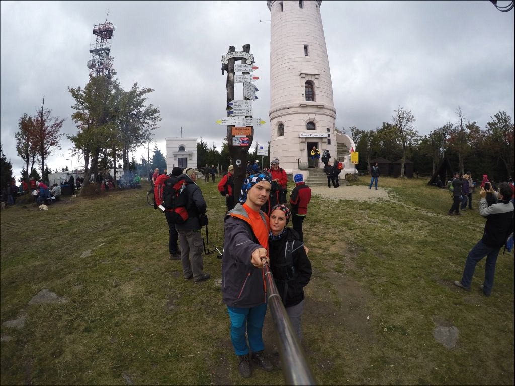
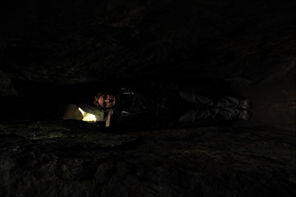
Our time was good, too good, so we decided to reach the fourth summit on the same day. For this purpose, we went to the most interesting place during the whole trip, that is to the Table Mountains National Park. We started the ascent along a short but steep yellow trail. At the top, we paid to enter the tourist route and went for a walk between the rocks. Some formations were really impressive. The route was interesting, in some places you passed through very narrow and low gaps ... people who are a bit larger or with claustrophobia may have quite a problem there. Every now and then there are viewpoints with beautiful views on the route. The tourist route ended and several hundred concrete steps led to the exit. We went to the top without analyzing the map, we decided that we will stamp it later. At the bottom, it turned out that our route ends on the other side of the mountain and to get to the parking lot, we can go around it along the blue trail or return through the peak again along the yellow trail, but there were several hundred stairs to climb again, but in the other direction, i.e. up the hill . Dominika returned along the blue trail to the bus and I decided that I would run along the yellow trail upstairs, stamp the booklet and go down the other side. I got a little sweaty, but after 20 minutes of running through Szczeliniec Wielki, I was already in the parking lot.
The Stołowe Mountains is a beautiful place and 3 hours is not enough to stop admiring them. We will definitely come back there, at least for a few days.
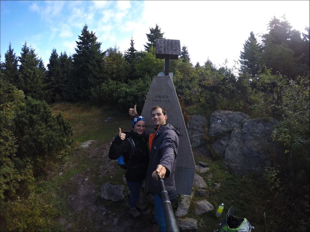
Tired, we headed towards Kudowa-Zdrój, where we replenished our food supplies, and then we headed towards the Sudeten highway. We spent the night in the Pod Sołtysią Kopą parking lot, where the temperature had dropped almost to 0 degrees at night, and we had not yet obtained a parking heater, so we were a bit cold. In the morning it was hard to poke your nose out from under the warm duvet. I prepared scrambled eggs, and the beautiful view was compensated by my frozen hands. Right after breakfast, we set off to Orlica, the route continued through the forest, at one point a huge deer with impressive antlers crossed our path, in the morning and evening we can only hear their roaring in the area. The further way is pleasant for us by berries, also of considerable size ... Probably no one has gone this way for a long time. Just before the summit, we have a problem with choosing the road, there are no signs, and the road is divided into 3, we chose the most trampled one and after 5 minutes we reach the highest peak of the Orlickie Mountains - Orlica. We go down the same path, eating blueberries.
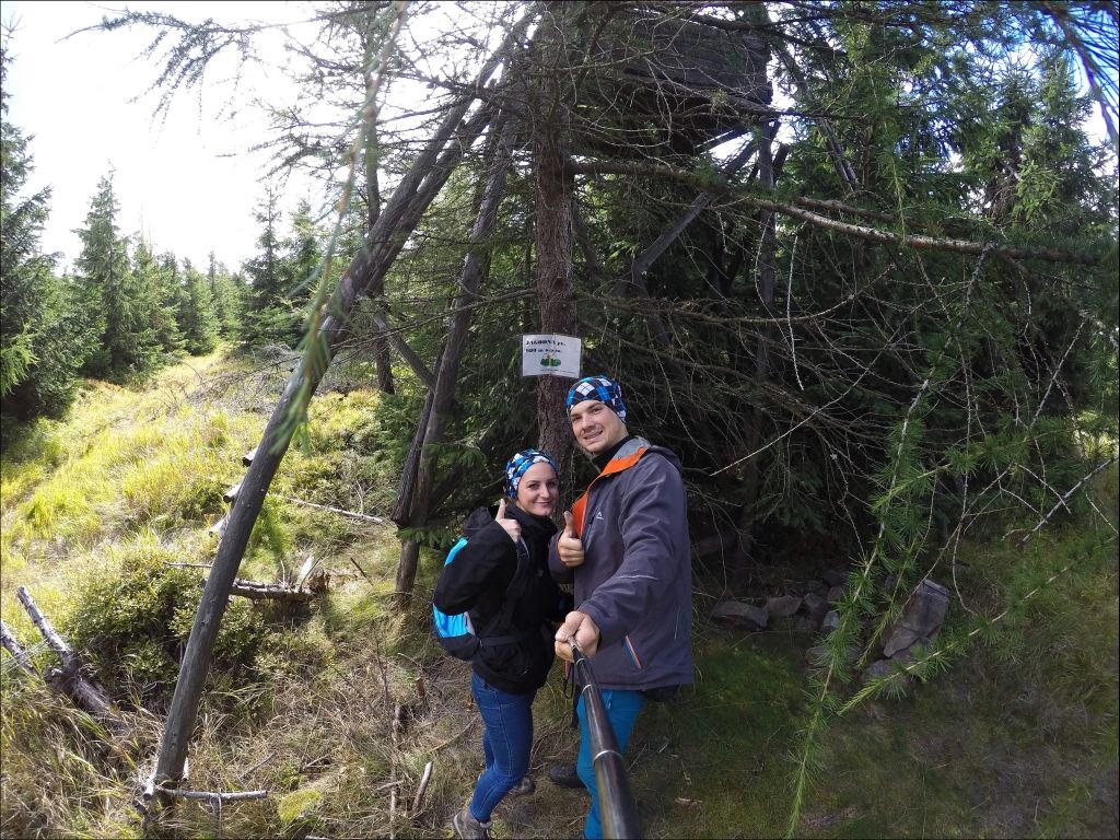
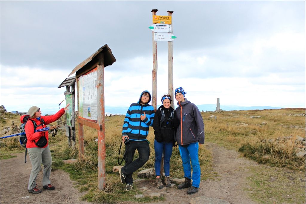
The next peak on our list was Jagodna. The route is pleasant, practically non-stop on a gravel road with a slight slope. However, there is no trail to the top, so we look at some helpful markings ... On the post next to the road, I noticed an arrow and the word Jagodna drawn with a marker. We cross the ditch and through the bushes we reach the old hunting pulpit, where the summit is located. A quick photo and we continue towards Międzygórze. We travel the road along the Sudeten highway, well ... to the hostel near Jagodna, the road was new, of great quality, a bit behind Jagodna, we could feel like in the Albanian Mountains, grass grew out of holes in the asphalt, the asphalt turned into gravel, a hole in the hole, we didn't exceed 30km / h for almost 20km. On the way, we pick up a hitchhiker who informs us that we have been the only car on this road for a long time. We are not surprised at all. It turns out that Paweł also gets KGP, only by hitchhiking. Paweł accompanies us on the way to Śnieżnik, the ascent was long and quite steep in some places. Conversation with our newly met friends makes the hardships of our journey more pleasant, after all, it is already the third summit today. 30 minutes before the summit of Śnieżnik, we sit down under the shelter, the temperature is 6 degrees, and the strong wind makes us feel a much lower temperature. At the top, there is a beautiful view of the Polish and Czech sides. Clouds are flowing in the sky like crazy. From the conversation, we learn that Paweł has the same heights to climb as us, so without thinking we take him further with us.
There are 3 peaks left to the closure of KGP in the Sudetes. The three of us go to Bielice, on the way we find a nice place to stay, light a fire and exchange travel stories until late in the evening. Paweł has traveled almost all of Europe by hitchhiking, and now he is planning a trip to Asia.
We choose the green trail to reach Rudawiec and the Anvil. The weather is bad, it is not raining, but the clouds stopping against the tree crowns cause water to condense on the leaves, which then fall on us. The temperature is also not too high, but the trail goes through the Forest, which at least holds the wind well. The beginning is quite steep, but then we march along the ridge along the Polish-Czech border. In Rudawiec, Paweł stated that he would stand on his hands for a photo, but he did not work out a bit and fell down onto the rocks behind him: P We have the last peak left to climb - Góra Kłodzka. We choose the blue trail. At the end, we got a solid kick. We have four intermediate peaks to overcome, the climb starts very steeply, the calves start to burn, we go up, and there we go down ... a steep climb again and then down again three or four times ... The blue trail connects the yellow one we have to climb. Follow the yellow trail to the summit, which is Kłodzka Góra. There is a right arrow on the path, at first we thought someone was playing stalking, but we see a yellow sign between the branches. There was also a red box with a stamp on the post. A great solution, it should be like this at every peak. We went back to the car. Paweł still has Biskupia Kopa to conquer, we won it this winter, so we drop Paweł from behind Prudnik, on the road to Jarnołtówek, and we say goodbye. Paweł gave us a marshmallow to say goodbye. What a guy! :)
We climbed 15 peaks in 5 days. We met a great man. We traveled another 1000 km with our minibus around Poland. There are only two peaks left to reach KGP, the highest - Rysy and the lowest - Łysica. Now it's time to come back to the sad gray reality :(
More photos from the trip are in the gallery next to it :)
And this is the current list of peaks we have climbed:


We are two students of Tourism and Recreation at AWF Katowice who want to visit the deepest corners of the world. Our teaser and passion for adventurous journeys, combined with Bartek's childhood dream from childhood, resulted in the purchase of an old school square - Tripciak :) The idea to buy a bus and tour the whole world was born when little Bartuś, who was only 5 years old, saw the cult fairy tale for the first time Scooby Doo and their crew in the crazy The Mystery Machine ... additionally infected with a travel note from an early age. From that moment, he started dreaming about his own bus, where he will be able to visit the whole world, getting to know foreign cultures, people, curiosities and secrets that the world hides;) Finally, after 16 years of dreams, he managed to buy a worn VW T3, which served almost 20 years as German ambulance - becoming the apple of his eye. After stormy deliberations, together with his chosen one, they named him Tripciak gloBus! We also invite you to our blog: http://tripciakglobus.blogspot.com/