Free navigation on the phone - is it worth using?
Can the free navigation on the phone successfully replace a professional device with paid maps updated? We checked and we already know that it is. However, you should be aware that there may be some problems from time to time ...
Do you want to replace the standard navigation with an Android smartphone? I did just that!
I have already used many navigation systems, and for the last 2-3 years I have used AutoMapa successfully. However, I had it installed on a very slow device (I had to wait a few minutes for the system to boot), and besides, I was irritated by the need to periodically pay for subsequent updates. Besides, when I went to Germany for a few days, I did not want to buy a map of the whole of Europe.
So before I made another transfer, I decided to check how a phone "armed" with free maps would work in the role of navigation. But wait a minute ... It is not enough to download navigation from the Google Play store and go on a journey. Before that, you have to take care of the appropriate conditions.
Get ready for your trip
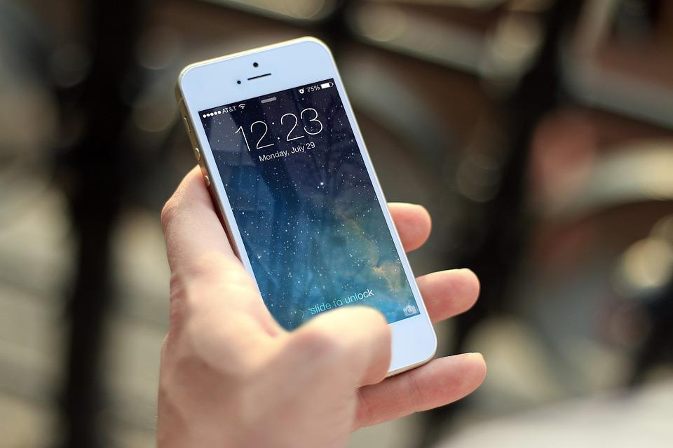
First of all - the car must have a USB output , in addition, placed in such a good place that the telephone cable can reach it. This is important because a long journey with the phone on, even if the screen will turn off from time to time, will effectively drain the battery of each camera. If your car does not have such a convenience, you can purchase a suitable USB adapter for the cigarette lighter (12V) .
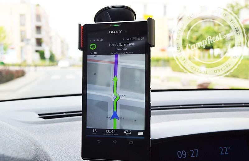
Second - you need a holder that fits your phone . I decided on an inexpensive, universal model from Allegro, which with its arms covers a phone of any size (like a clip). During the holiday trip, the handle worked very well. The phone was quite stable, and the suction cup holder never fell off the glass.
Thirdly - the phone should have a large screen diagonal so that the maps are legible and the use of touch navigation is comfortable. In the case of the 5 inch screen, I did not notice any problems. I think that a 4-inch screen could also be enough.
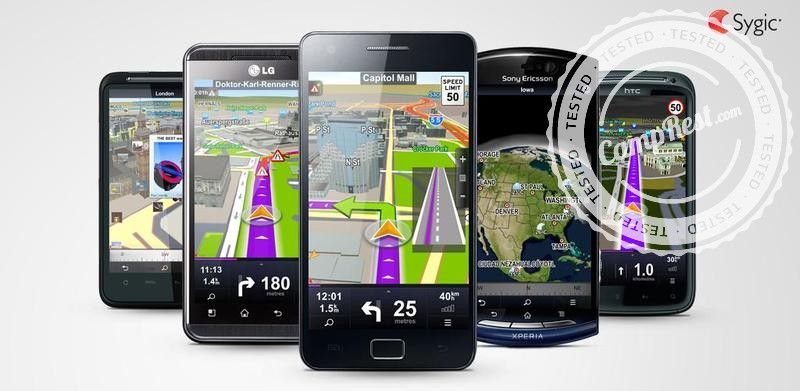
Sygic and Be-on-the-road
After these conditions are met, we can find out about the available applications. Some of them are paid, others are available for free, but for an additional fee you can expand them with additional options.
I was interested in the most economical option. I was looking for a navigation that would be free and would not require internet connection while traveling. Such a decision had one fundamental consequence - it is not possible for us to use the system in the offline mode, so using only the GPS module, we could obtain information about the current traffic volume.
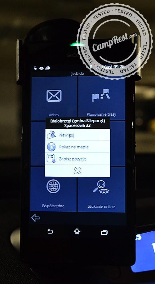
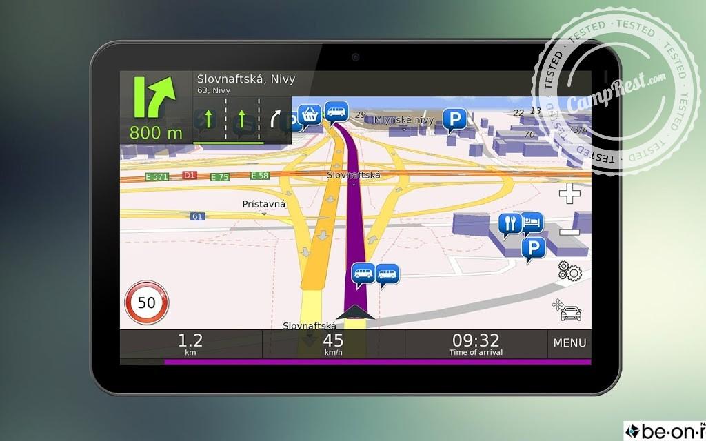
Ultimately, I installed two systems on my smartphone. The first one, which I immediately liked the interface, is called Be-on-the-road . The second, which was to serve as a fallback solution in case of problems with the first navigation, was Sygic . Such a solution made sense because the first system is based on maps developed socially by internet users, while the second one is partially supported by TomTom . So if there were problems with the maps in one program on a given route, those in the other should be the rescue. In practice, however, the maps of both systems turned out to be virtually identical.
Sygic - good for a walk
In fact, I didn't really use Sygic maps during my holiday trip. Although they always traced the route correctly when I used them and led me well to my destination, I was discouraged by their slightly archaic appearance (for me these maps were too colorful).
There were other reasons as well. First of all - Sygic navigation constantly reminded me that I had the free version (there was a message on the screen). Secondly - in the free version there is no lane assistant or an additional view of junctions, so it may happen that when we reach the indicated place, we find out too late that we should already be on another lane. There is no voice navigation in the free version, and after turning off the screen, restarting it each time requires unlocking the lock screen.
This navigation , however, proved to be very good during… walks . As a help for a tourist moving around a foreign city, it turned out to be extremely effective and showed the way both in a straight line (you can look for shortcuts) and along the main roads.
Be-on-the-road with minor issues
In the case of Be-on-the-road, the opposite was true. For some reason, the navigation stuck most often during walks, but on the road - except for a few situations, it did a great job.
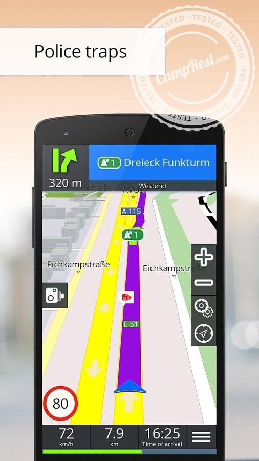
The clear interface made it possible to use the system with pleasure. On the screen, we see not only the map, but also the distance to the nearest intersection and the direction of the turn , as well as speed limits on the road we are driving and our current speed (it is worth knowing that the one determined by means of GPS is usually more correct than the speedometer readings of the car).
The pluses include the fact that the screen can be turned off at any time and the voice messages will still work in this mode. After restarting the screen, the map view appears immediately, so you do not have to (as in Sygic), "remove" the lock.
Most of the installed maps turned out to be up-to-date and led to the destination well, although unfortunately this did not apply to the roads that were put into use within the last year. Unfortunately, if a road was rebuilt or temporarily closed for traffic, there were problems. Back then , Be-on-the-road could stubbornly force the maniac to return to the obsolete route and sometimes even choosing the detour option did not cause any change.
It also happened that the navigation got stuck at a key moment , before a crossing that was very important to me, on which the further course of the route depended. After rebooting, the navigation went back to the automatic parameters, disregarding my previous settings. As a result, I had to continue my journey on a different route than planned, which - I admit - irritated me a lot.
Another problem was that voice prompts often said "take a slight turn" to the right or left when the maneuver concerned was about a 90-degree turn. You also have to get used to the fact that the expressway is called a "highway" by the system (the speed limit displays were shown correctly, however).
Despite everything…
After using navigation for several hours each day for a week, after traveling two thousand kilometers in Poland and Germany, I must admit, however, that I can classify the emerging problems as exceptional situations. In general, the free applications worked very smoothly and efficiently , and the maps themselves, although not always the latest ones, had at least the advantage that you did not have to pay for their updates.
For me, as a person with poor orientation in the field, something else was also important. When using AutoMapa, I sometimes "missed" a turn recommended by navigation or turned too early. However, when I used Sygic and Be-on-the-road, nothing like this happened to me even once. I do not know if this was due to the fact that when using free maps I had less confidence in them and therefore I was controlling the situation more urgently, or if the mentioned applications simply work better with the driver.
But I know one thing: for now I'm not going to go back to "traditional" navigation.


Sometimes it is better to get lost than to ask for directions too much. Aldous Huxley