ALPINE ROUTE

ALPINE ROUTE – main image

We have a week off and a total of 9 days - something has to be done with such a beautifully promising free time. We planned to go to Croatia, but eventually decided to go there during the holidays. There was an Italian idea around the coast, but definitely not enough time. That is why we finally decided to go to the Alps.
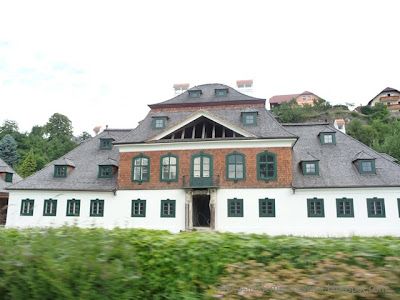
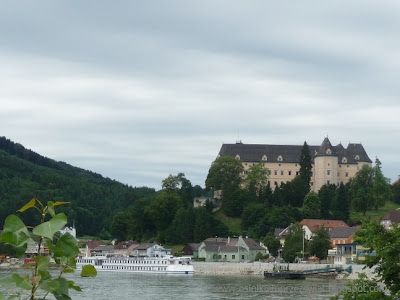
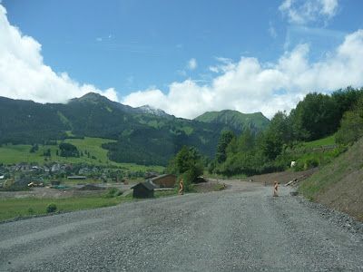
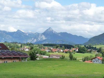
Everything is packed - here we go. We pass through the Czech Republic, and we cross the border with Austria in the small town of Reinthal - near Breclav (note the passage is only below 3.5T). Driving along side lanes is so different from the main roads. Calm down, there is no traffic and small towns have their own charm. We reach the main road from Mikulov. At the first possible station, we buy a vignette - as we continue to enter the motorway, which is getting closer to the Czech border every day.
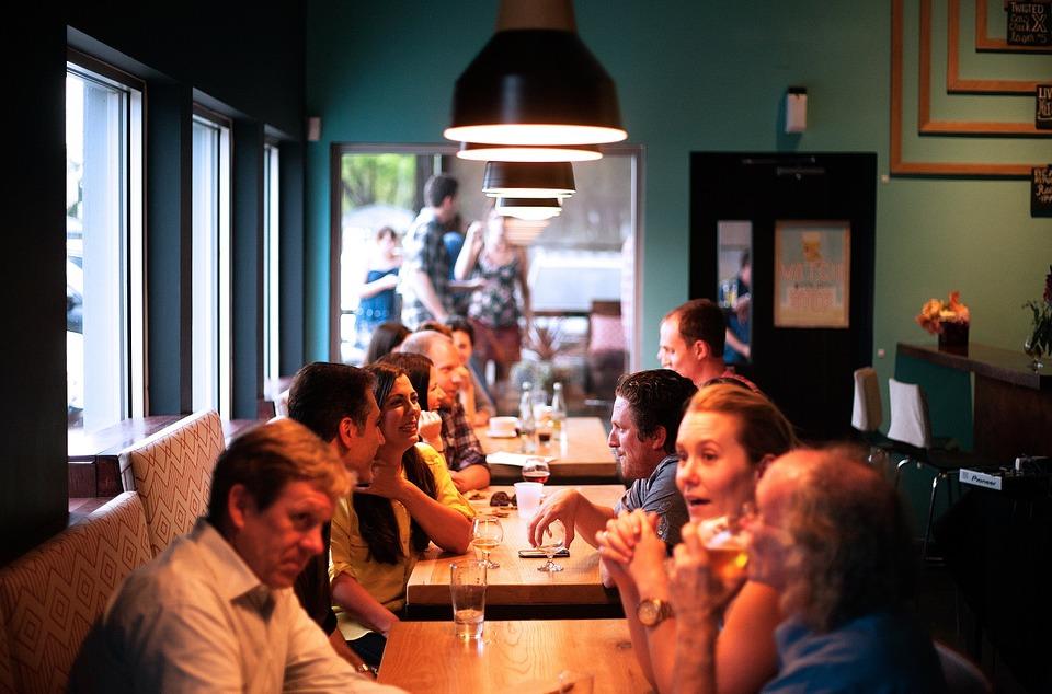
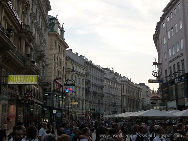
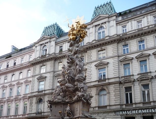
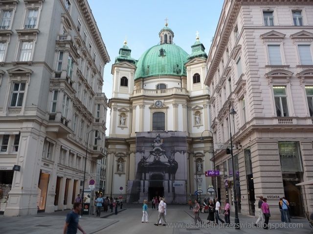
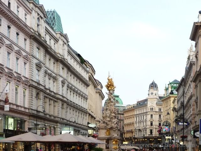
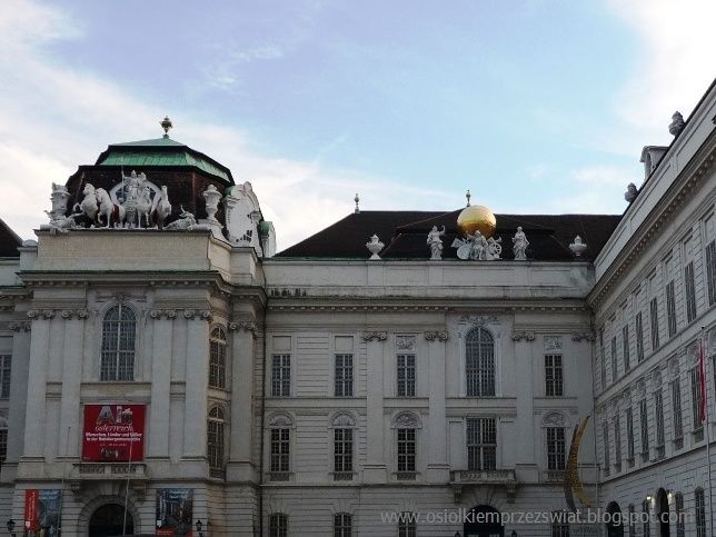
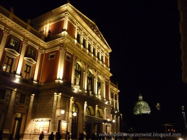
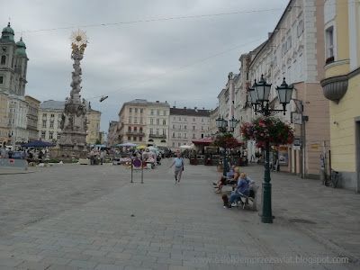
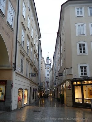
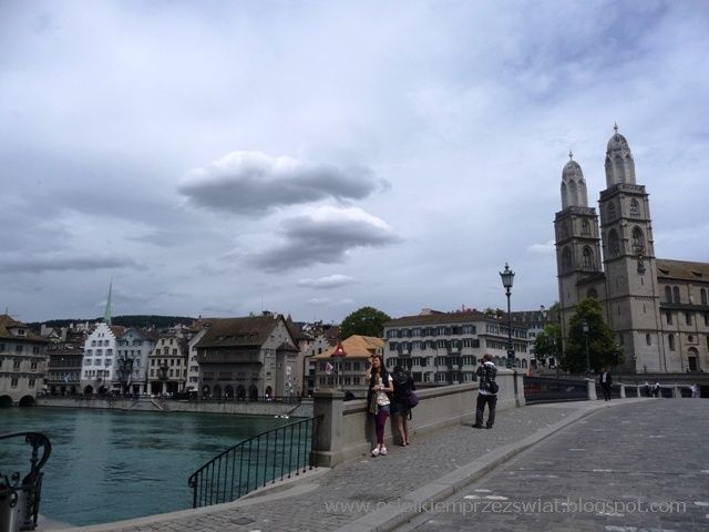
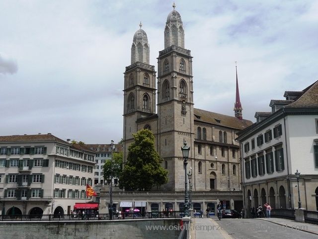
We often pass through Vienna, but always along the ring road. This time we decided to devote a little more time to it. A small donkey, therefore, after making a round along the beautiful, blue Danube, we park in the vicinity of the city park and go for a walk along the Viennese streets.

ALPINE ROUTE – image 1

ALPINE ROUTE – image 2

ALPINE ROUTE – image 3

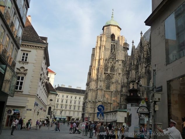
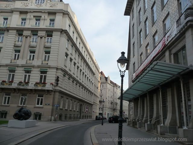
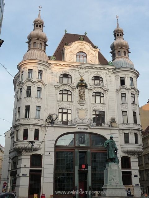
How many years have passed when we were here the last time ... then it was winter, now we have summer, but Vienna can delight you at any time of the year, not only during the day and night.

ALPINE ROUTE – image 4
ALPINE ROUTE – image 5
While strolling, we go deeper and deeper into the old town, enjoying both the narrow streets where it's hard to meet someone, and the bustling promenade with fountains and stylish tenement houses. But Vienna is not only streets, it also has numerous churches, with Domkirche St. Stephan.
ALPINE ROUTE – image 6
ALPINE ROUTE – image 7
ALPINE ROUTE – image 8
Vienna looks as beautiful as during the day also at night, unfortunately the camera plays tricks in such a light - but believe the word, the center looks really charming after dark.
ALPINE ROUTE – image 9
ALPINE ROUTE – image 10
There are many castles in the near and distant surroundings of Vienna - just as recommendable as the city itself. We leave Vienna, find a nice quiet rastplatz and, looking forward to the mountains, we go to sleep.
Before we reach the mountains, however, we go to Krems from where we go west along the Danube gorge. It is here between small towns dotted with vineyards, and fortified castles guard the peaks of the nearby hills. The Danube gorge can be visited in several ways. We saw a lot of cyclists, you can also go by boat, or traditionally by car in various variants. At one point, our attention was caught by a barge moving at a speed of "less than zero" with a colorful flag fluttering proudly.
ALPINE ROUTE – image 11
Small sleepy towns are tempting to delve deeper into them and stroll their alleys for a while. Unfortunately, in many of them we saw a prohibition sign above 3.5T.
ALPINE ROUTE – image 12
A few kilometers beyond Krems, on a hill there are the ruins of Durnstein Castle, where Richard the Lionheart was reportedly imprisoned in the 12th century.
ALPINE ROUTE – image 13
There are many vineyards and wineries in Weissenkirchen - a longer stop is guaranteed when you drop by (the Riesling wine festival is celebrated here in mid-August).
St Michael welcomes us with another fortified castle, and behind a bend on a nearby hill, another rises.
ALPINE ROUTE – image 14
Vis a vis Melk there is a large parking lot with a nice parking space. So we go for a walk along the coastal path. On the other bank, the Benedictine Abbey towers over the water - one of the most beautiful architectural structures in Austria.
ALPINE ROUTE – image 15
There is a car near the car park to warn against the effects of careless driving.

ALPINE ROUTE – image 16
Continuing along the Danube, we follow more or less side lanes to Linz. Along the way, we pass picturesque villages and towns and go into a side road somewhere on some nearby hills. The road is so narrow that you would have to miss another car - luckily we didn't meet any of them, because we just took the road leading between the vineyards.

ALPINE ROUTE – image 17
ALPINE ROUTE – image 18
ALPINE ROUTE – image 19
Because we are "capable" and the navigation is even "better", we come to the market in Linz, where theoretically we should not be a car. There is a cable car to the Postlingberg summit nearby, which after covering 2.9 km (250 m difference in elevation) within 16 minutes (supposedly inscribed in the Guinness book) goes up to the fairy-tale grotto.
ALPINE ROUTE – image 20 ALPINE ROUTE – image 21
From Linz we get to Steyr, which surprised us very pleasantly. About many places, guidebooks say "beautiful, picturesque, captivating" and it really is. The square is surrounded by buildings from different eras: gothic, renaissance, baroque and rococo, the styles here are beyond measure. In the guide, they say that it is magical during the holidays - special Christmas exhibitions, street singing of carols, Christmas mail - in this scenery it is certainly fairy-tale like.

ALPINE ROUTE – image 22
ALPINE ROUTE – image 23
Taking side roads, we continue to the west passing Grunden on the lake.

ALPINE ROUTE – image 24
ALPINE ROUTE – image 25
We are leaving Salzburg for the evening. It was falling apart, but when we are here, we will see the city, finally mom's raincoats. We park somewhere on the edge of the center and go for a walk. Despite the rain, which in the meantime has fallen apart, we visit the Residenzplatz and look at the nearby streets and monuments: the cathedral, churches and the castle rising nearby. If the weather were even a tad more merciful, we would probably go further, but this dripping, or rather pouring rain, decided for us - the direction of the car, to which we reach completely soaked.

ALPINE ROUTE – image 26

ALPINE ROUTE – image 27
ALPINE ROUTE – image 28
ALPINE ROUTE – image 29
ALPINE ROUTE – image 30
With the idea of returning to Salzburg, we enter Germany again, where we stay overnight in the first possible parking lot - like a dozen kilometers away, and the weather is much different, sometimes even the sun will rub.
The kilometers pass quickly on the highway. Somewhere on the right is the Chiemsee lake, on which the Herrenchiemsee castle is located on the island - the seat of Ludwig II of Bavaria. There is also a car park with a restaurant, but it is forbidden to stay overnight - maybe they have a camping nearby. From the shore, you can barely see the island, not to mention the castle, so after breakfast we go to our beloved mountains. At exit 99, we turn onto Bad Tolz and then onto GaPa, actually Garmisch-Partenkirchen, but the name is long. In Kochel am See and Walchensee, we stop by the lakes for a longer time - the mountains slowly begin to present themselves in all their glory. Driving further, more peaks emerge - we are finally in our element.
ALPINE ROUTE – image 31

GaPa is a charming town - rather quiet at this time of the year. The village overlooks the Zugspitze, the highest mountain in Germany and the Bavarian Alps, which can be reached by cable car. The weather is encouraging, so we start looking for the queue.
ALPINE ROUTE – image 32

Unfortunately, after a few minutes the weather plays a trick on us. The mountains are more and more obscured by clouds, it begins to rain… .ehhh
So we're going back to Austria. We cross the border and what - and the beautiful sun comes out. This is how it is with the mountains - they are beautiful, but also capricious. After crossing the border, the road surface changes a bit.
ALPINE ROUTE – image 33

We enter Germany again, near Fussen, where the two castles Hohenschwangau and Neuschwangau rise on the hills above the Schwangsee lake. Hohenschwangau is a golden castle built in the English Gothic style in the 19th century by Ludwig of Bavaria for his father Maximilian, while Neuschwangau is a fairy-tale solitude of Ludwig II of Bavaria.

ALPINE ROUTE – image 34

ALPINE ROUTE – image 35

The route from Fussen to Immenstadt is very picturesque and follows side roads (310-308). We are passed by four convertibles with English numbers. They rolled a little after the donkey and then two of them went blue and the other two were still following the donkey. We got to a roundabout where the first two were rolling, waiting for the others. Those that followed us, instead of turning right immediately, drove around the roundabout and had to roll again after the donkey.

ALPINE ROUTE – image 36

ALPINE ROUTE – image 37

On the way, a storm catches us - we find a parking lot and cook dinner, looking at the warm streams of rain through the open door.
ALPINE ROUTE – image 38

In a village we pass a sunny house. Panels are everywhere. On the house, barn, well, covered table. We stop for the night in the parking lot by the motorway at the height of Wangen.
 
We drive to Lindau in the morning - Lake Constance greets us with cloudy weather - the mountains are barely visible. We are heading to Bregenz, from where, with good visibility, you can go to the top of the nearby mountain Pfander and admire the surroundings - we were probably rude because the weather didn't make it for us.
We get to Feldkirch, the westernmost city in Austria. The city dates back to the 12th century and has a well-preserved old town.

ALPINE ROUTE – image 39

ALPINE ROUTE – image 40

Entry to Liechtenstein is associated with entry into Switzerland, with which he has a signed "union". We drive to the border crossing - we have had no control for a long time. The security guard took the passports and disappeared somewhere. Apart from us, there is no one at the crossing. He came back a few minutes later, glanced at the back of the car - the turists, and let it go. As we planned to enter Switzerland, we immediately buy a vignette for motorways - there is no border crossing any more.
Liechtentein lies entirely in the Alps and uses the Swiss currency here, and the borders are guarded by the Swiss customs and border services - the country is therefore largely "dependent" on Switzerland. The country is mostly mountains. There are not many monuments here - only Vaduz with its castle set on the rock.
ALPINE ROUTE – image 41

ALPINE ROUTE – image 42

ALPINE ROUTE – image 43
The city center is "two streets at the cross", but the location among the beautiful mountains of the Rhaetian Alps makes it worth visiting this place. From the vicinity of the castle (a bit steep climb) you can admire the surroundings. Riding even higher above the castle, more and more beautiful views emerge. The road is quite narrow, a bit steep - but you can drive on it. At the end it narrows down to a one-way street as far as Triesen. There, after passing the narrowing, there is a beautiful panorama of the nearby peaks. To go down again, you have to watch out for the brakes, because the serpentines are quite steep and strongly twisted in places - but worth the views.

ALPINE ROUTE – image 44

ALPINE ROUTE – image 45

Now we can enter Switzerland without embarrassment. We have a vignette, we have a full tank of gas. We are going on the highway, but how different from the German one, where the kilometers passed so quickly. Here we rather look for a parking lot to capture the beauty of the area. And see what you can see for yourself: there is a parking lot next to the lake, from which a path leads towards the lake, you can stretch your bones a bit.
ALPINE ROUTE – image 46
The second, probably even larger lake is right in front of Zurich - but from the highway it is less visible and the area is not as beautiful as before. Zurich is a beautiful city, although we do not like big ones. Financial centers, luxurious streets, but also nice tenement houses and views of Lake Zurich. Whoever is afraid of spiders, better pay attention to them here.
ALPINE ROUTE – image 47
ALPINE ROUTE – image 48
ALPINE ROUTE – image 49
ALPINE ROUTE – image 50
Another city is Lucerne, which attracts attention with the old town, with a wooden covered bridge from 1333 with a stone tower that used to be a prison. In the old town you can admire gothic tenement houses, a Renaissance town hall and city walls with towers. The city is very picturesquely situated on Lake Lucerne.
ALPINE ROUTE – image 51
ALPINE ROUTE – image 52
ALPINE ROUTE – image 53
We leave Lucerne - here they direct to the tunnel under the St. Gotthard. We would almost turn right if we were impressed. There are countless tunnels in Switzerland. They are found not only on highways, but also on many side roads. After driving, there are usually more wonderful views - unless someone is unlucky and just hits the fog.
ALPINE ROUTE – image 54
ALPINE ROUTE – image 55
After exiting the highway, the roads can be winding. We thought for a long time which one we should actually go, but after crossing the bridge and then making a snail through the tunnel, we already knew. Snow-capped peaks are slowly emerging.
ALPINE ROUTE – image 56
We are in the Jungfrau area. The three peaks of Jungfrau (4158), Monch (4107) and Eiger (3970) and the largest Alpine glacier Aletsch (24 km long, 900 m thick) are a beautiful sight. For those willing, it is possible to go by cable car to the Jungfraujoch pass (approx. 3500m) - only you have to find nice weather.
ALPINE ROUTE – image 57
We enter Lauterbrunnen (loud springs) and it is really loud - 72 waterfalls, and a camping under one of them - good luck at night. At the end of the road there is a hotel / restaurant with its own car park from where you can walk into the nearby valleys.
ALPINE ROUTE – image 58
The peaks hide in the clouds, but from time to time our patience is rewarded, because the sun appears, literally for a minute or two, and then disappears again. A brook murmurs nearby - in fact, it hums quite loudly, as a lot of water flows from the glaciers. Passing by the campground, which is located under the waterfall, we really wondered who came up with the idea of such a place - but you can see many people liked it, because there were a lot of cars there. For this reason, signs prohibiting parking at night appear in the few parking lots in the vicinity.
ALPINE ROUTE – image 59
ALPINE ROUTE – image 60
One last glance at the peaks hidden in the clouds, a photo session at the train station and we head to the highway towards Bern. It's the end of June so the days are really long here. Therefore, we decide to go to the town of Thun, where there is a castle with a panoramic view of the surroundings. There is a bit of a problem with parking next to the castle, but there is a gas station nearby and a small parking lot in front of the castle entrance. You reach it by walking through the stone gate and then walking along the cobbled streets. You can come back up the winding stairs and then along the narrow streets between the stone walls.
ALPINE ROUTE – image 61
ALPINE ROUTE – image 62

ALPINE ROUTE – image 63

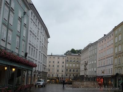
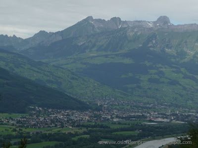
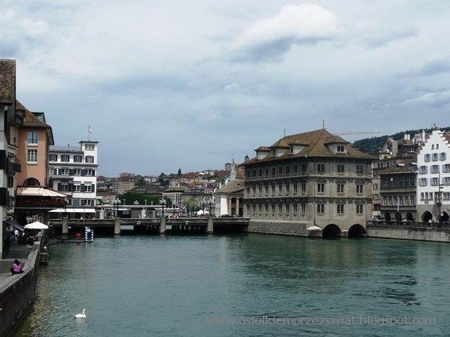
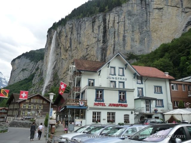
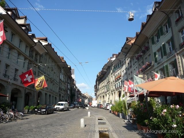
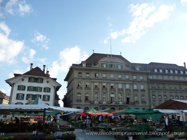
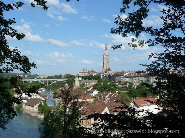
We enter Bern quite early - the city is just waking up. Maybe that's why we have no problem parking in the very center - almost empty streets. The city, of course, lies in the mountains, the peaks of which are covered with snow. The picturesque city, founded in the 12th century, with the old town on a 2-kilometer hill surrounded on three sides by the Aaru valley, is a place that can stay for longer. The most important buildings, the town hall, the parliament, the cathedral and the famous clock tower (with a clock measuring time with Swiss precision for 500 years) are located here.

ALPINE ROUTE – image 64

ALPINE ROUTE – image 65

ALPINE ROUTE – image 66

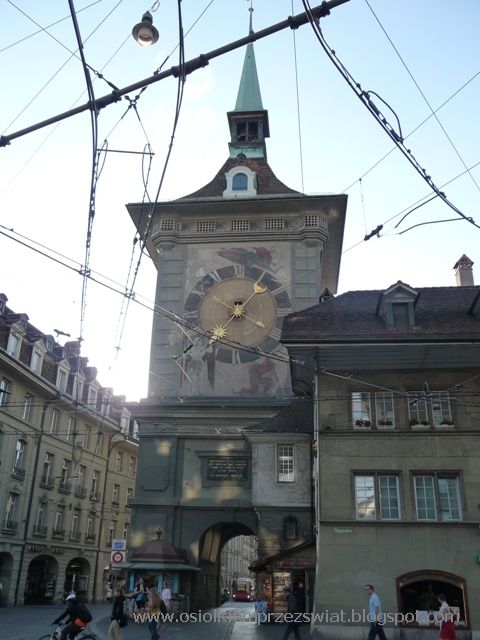
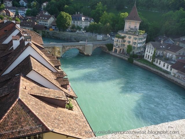
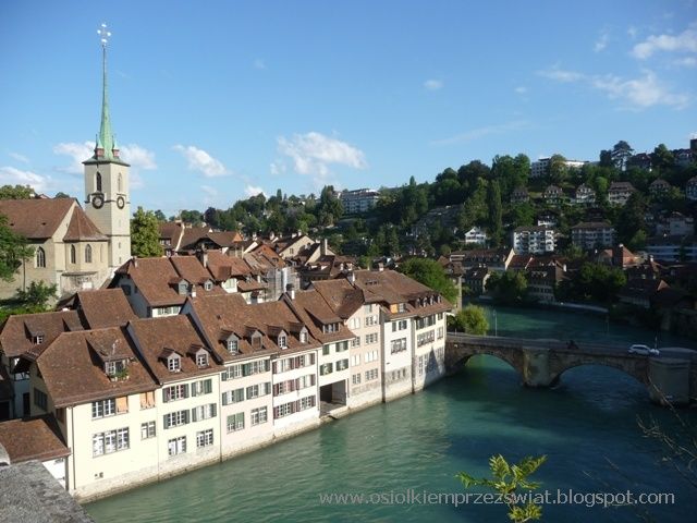
The views from nearby bridges can certainly be a graceful subject for postcards.

ALPINE ROUTE – image 67

ALPINE ROUTE – image 68

ALPINE ROUTE – image 69

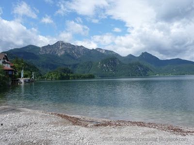
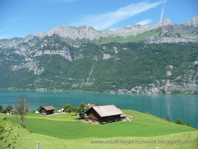
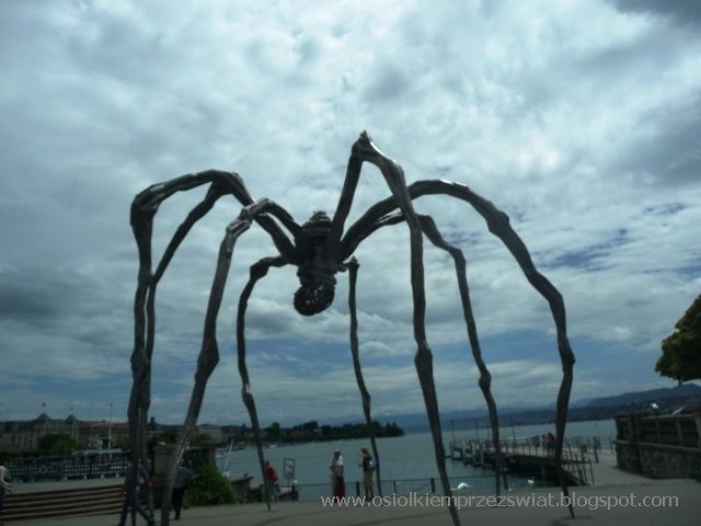
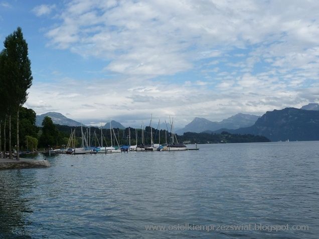
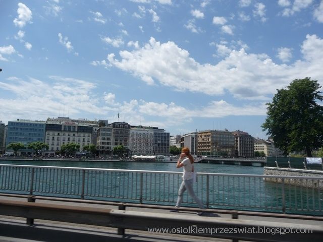
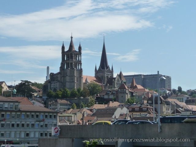
In order not to take the highways, which move quite a lot between large Swiss cities, to Lausanne for a change, we take a side road. At some point, we see a parking lot sign, so let's go. Nice in the forest, a lot of trailers even on it, so we go in. But with a little bit of shyness. After we got closer, it turned out that we found a gypsy camp. Pulling back is not really like. We stand on the verge. The traffic in the camp is just beginning, people lazily leave the trailers and start preparing for breakfast - normal camp life. They don't even pay attention to us. We also have breakfast and are on our way. A few kilometers further, we see a similar camp - only the police have just burst in there and are trying to chase it away. Lausanne is located on Lake Geneva - we've always thought that the land of lakes is Finland - and here, wherever you look, a lake - most of the cities lie just above them.

ALPINE ROUTE – image 70

ALPINE ROUTE – image 71

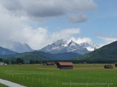
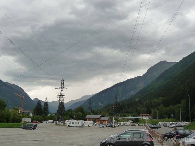
Geneva - it is equally beautiful, but you have to take our word for it, because we lost both batteries in the camera. That is why we had to stop for them to recharge because we had Chamonix and Mont Blanc ahead of us. We enter a large car park full of campers. There was a plan to go up, but they were expecting a storm and the queue was blocked - in fact in an hour, if it didn't start to rain, it was raining like hell. It disappointed us a bit, but what could be advised - maybe next time the weather will be better, there was no point in waiting until the next day as they said at the cable car station that the next day should be similar.

ALPINE ROUTE – image 72

ALPINE ROUTE – image 73

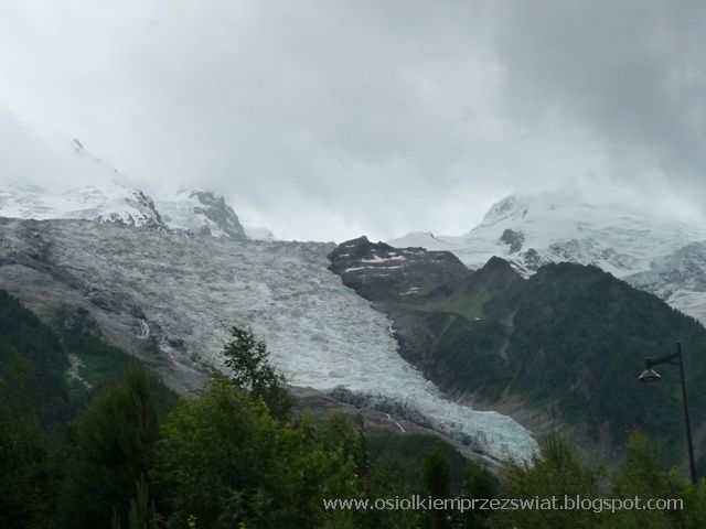
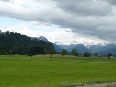
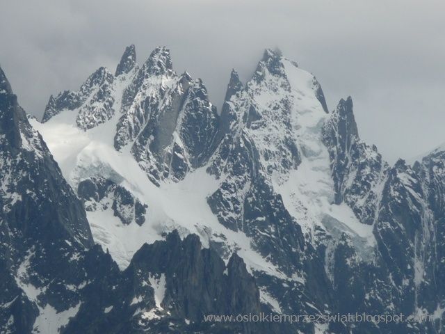
Well, we had nothing else to do but return to Switzerland through the Col de Montets pass. It was falling mercilessly, so we made a longer stop on it, hoping that the weather would finally have some pity on us. And in fact, after lunch, the sky started to clear a little - we even managed to see the alpine peaks in all their glory.

ALPINE ROUTE – image 74

From the pass, we descend a little lower to the border crossing with Switzerland, we drive up to the building, we stop - you cannot see the living spirit in the area. No, we are not going any further. After a few kilometers it brightens up - and that's the charm of the mountains.

ALPINE ROUTE – image 75

From there we go to Martigny - a beautiful exit, but also pay attention to the brakes (there is only one parking lot on the way with the possibility of stopping).

ALPINE ROUTE – image 76

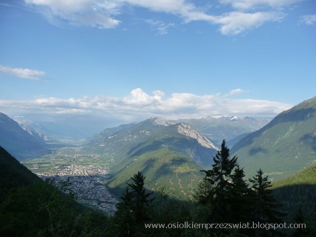
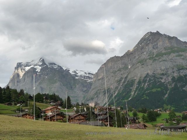
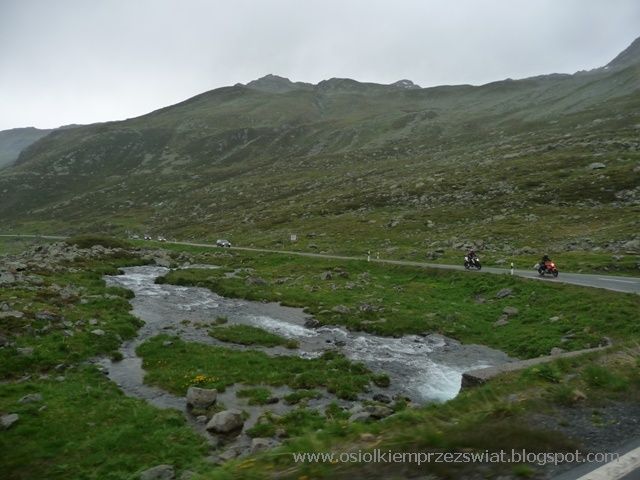
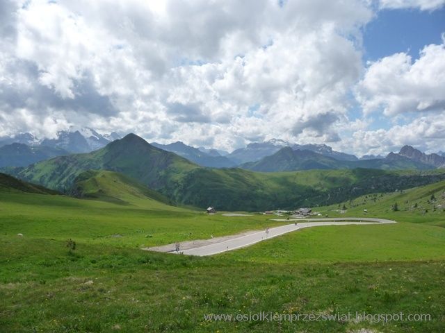
At the height of Sion, we turn right towards the Matterhorn. At first we go through the valley, the road begins to climb and climb, and from behind the next bends wonderful views emerge. We went so far in looking for more that we reached 2200 m to Arolla. The end of the road is a bit narrow and winding, but the traffic is heavy, we managed to pass another car even once. If you are in the area, it is worth coming here (it is better to turn back here, it can be difficult later).

ALPINE ROUTE – image 77

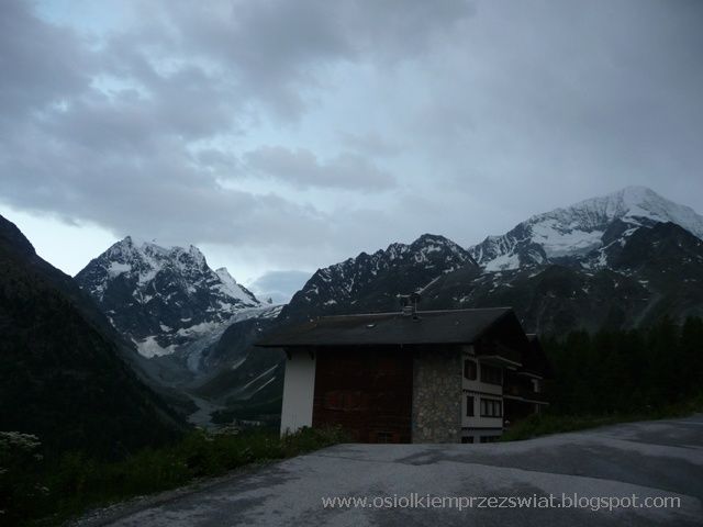
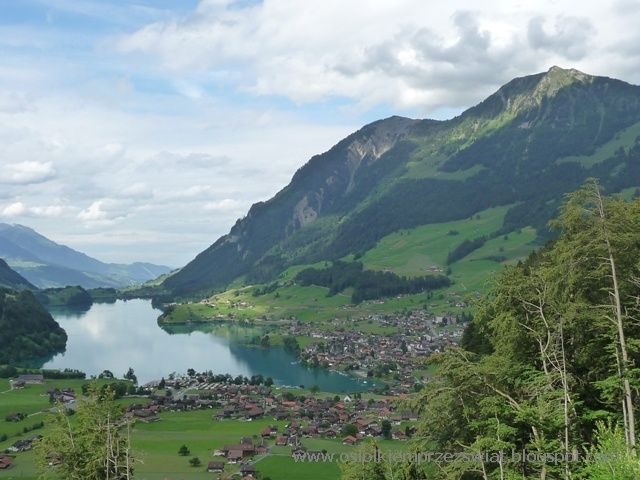
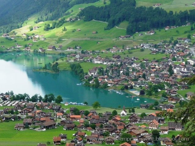
Coming back, we see how the clouds from Mont Blanc reached here as well. It's time to look for a place to stay at the 22nd, we are stopped for a while by goats by the pyramids in Euseigne.

ALPINE ROUTE – image 78

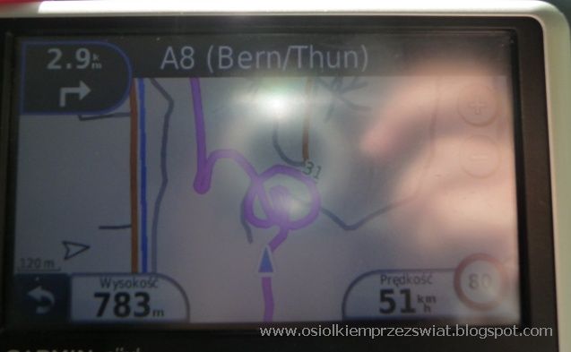
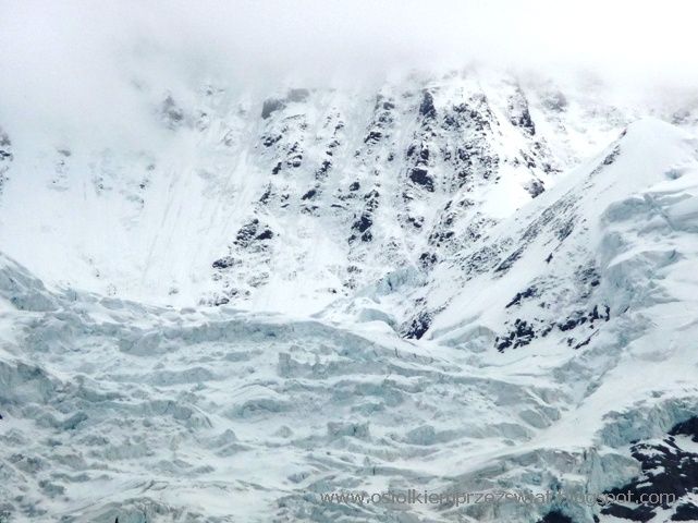
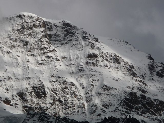
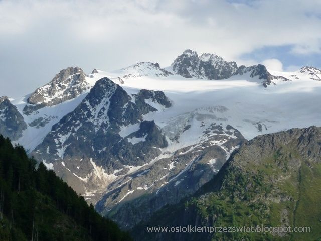
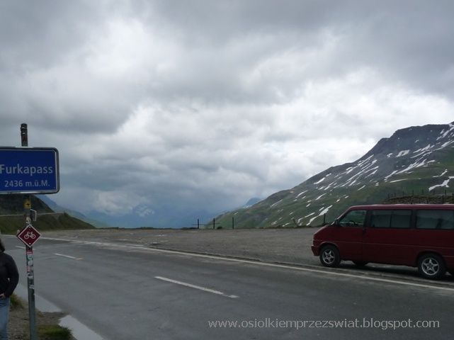
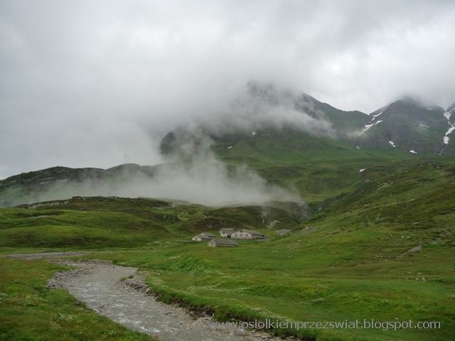
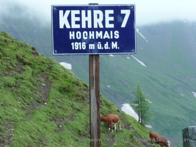
The weather here is a real lottery, sometimes it is pouring, sometimes sun, sometimes clouds. It all depends on fate and height. After spending the night in the Sion area, we drive to Gletsch. On the left, we now have a different perspective on the glacier and the Jungfrau. Before Gletsch, you can load a car on a train and take it to the other side under the Furkapass (2436), but we didn't come here to travel by trains through the tunnels, although the weather makes us stop for a longer time before entering Furka. The driveway is long and a lot of serpentine on it, steep in places (14%).

ALPINE ROUTE – image 79

At an altitude above 2000m and with such a slope, we must negotiate strongly with the donkey and convince him that he can do it. If it were lower, there would be no problems, but here the lack of oxygen can be felt a bit. Despite the unfavorable weather conditions, the views reward us with the effort of climbing. Such a driveway also has its advantages - you can freely take photos without fear that we will miss something interesting.

ALPINE ROUTE – image 80

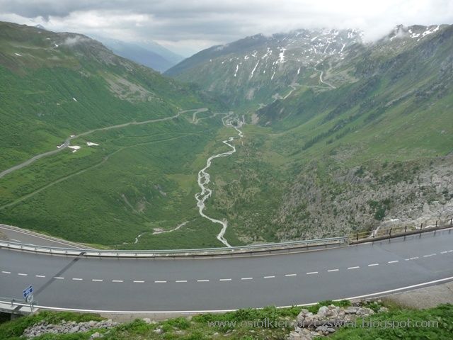
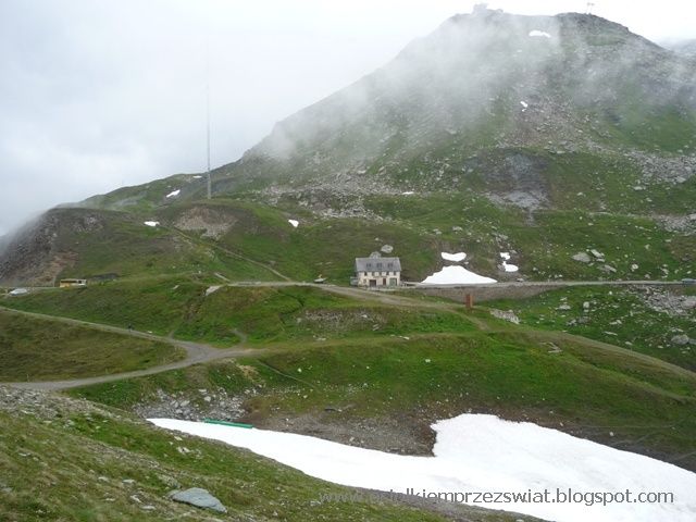
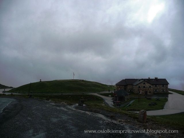
Traffic on the road is small, so if there is a need, you can stop - taking only into account the fact of starting uphill, which at such a slope may have different results in some places. There is a car park above the hotel and the road flattens out a lot - but again the altitude does the job. Finally, we drove onto Furka, and there was snow. We went for a little walk but 10 degrees brrr. On the way, we passed the soldiers returning from the mountains - when they slept here at night, I feel sorry for them brrr ...

ALPINE ROUTE – image 81

ALPINE ROUTE – image 82

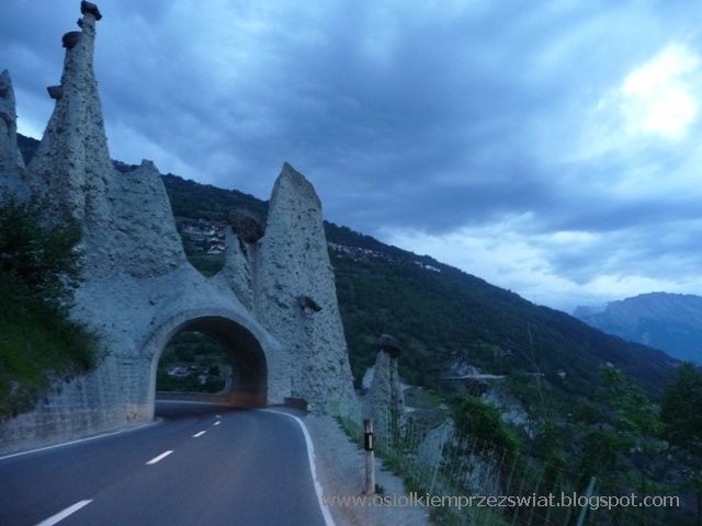
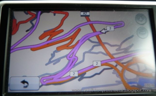
We leave Furka, but not entirely. We set the route and we have a dilemma which way to go…. Confusion with confusion - but this is how it is in the Alps, first the viaduct, then the tunnel and we go round and round.

ALPINE ROUTE – image 83

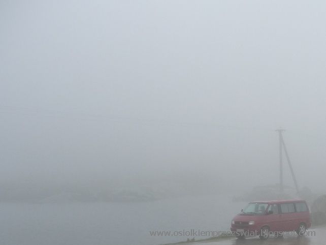
From Furka we enter the St. Gottard. Unfortunately, we do not have many photos because of the clouds that covered the area so tightly that after stopping at the pass in the parking lot, we only discovered after a few minutes that there was a lake 5 meters away. When it finally stopped raining a bit, we went to explore the area as much as possible. Luckily we were able to get back in the car before the next cloud. We are waiting for nothing changes, I think it will stay that way. There is a car going, then we follow it. And so we were descending the pass, staring at the two red lights in front of us - the road must have been winding - at least that's how I heard that I bend again because I couldn't see anything.

ALPINE ROUTE – image 84

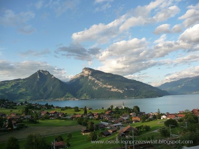
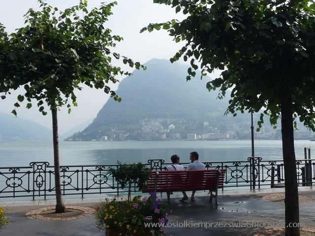
Via Bellinzone we reach Lugano, which is tucked into a small headland between Italian territory. It looks as if Switzerland wants to get some sun and warmth for itself.

ALPINE ROUTE – image 85

ALPINE ROUTE – image 86

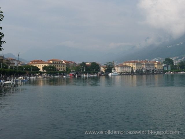
We also catch a piece of Italy, but unfortunately we just come back from work, so we stand and stand, and the opposite one goes and goes. Only the arrival of the police normalized the traffic on the shuttle crossing. Locarno greets us with the sun, although here you can also see that it has just finished raining. It is not for nothing that it prides itself on being the sunniest city in Switzerland.

ALPINE ROUTE – image 87

ALPINE ROUTE – image 88

As we drove through Bellinzone earlier due to a cloudburst, and we want to see the town, we return to a stop on the highway.

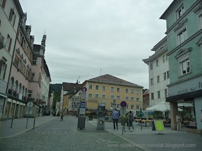
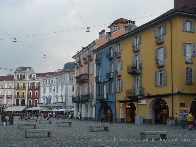
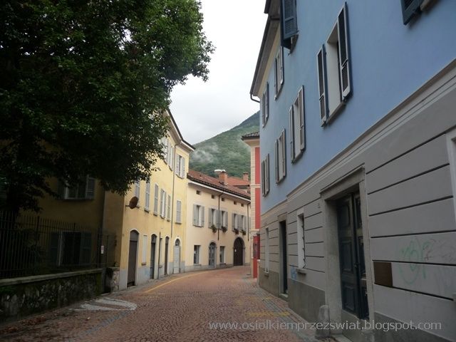
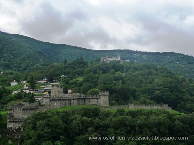
Bellinzona is a lovely little town, more Italian than Swiss style. Around 8.30 the town only comes to life, the streets are empty. Thanks to this, you can take a leisurely and leisurely stroll along the streets and visit the local castles (three), which together with the walls guarded the area. So we climb one of them, which offers a panoramic view of the city and the surrounding area.

ALPINE ROUTE – image 89

ALPINE ROUTE – image 90

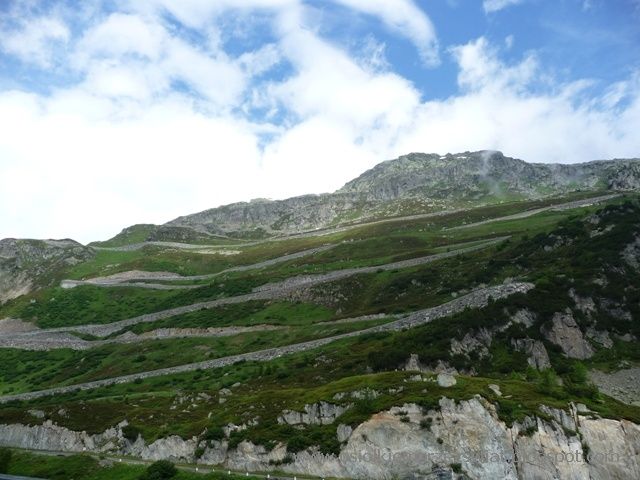
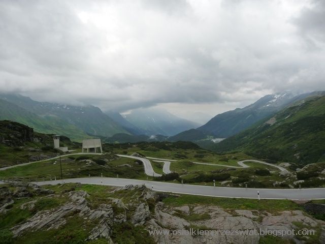
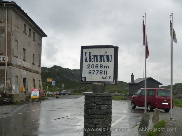
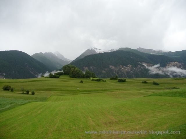
Going north towards Chur, you can overcome the Bernardino Pass, either through a tunnel or up a mountain (up to 10%). We slowly pass the last villages and climb the mountain. We did not meet any car on the way. Peace and quiet around, and the surroundings a bit like northern Norway, the weather also.

ALPINE ROUTE – image 91

ALPINE ROUTE – image 92

ALPINE ROUTE – image 93

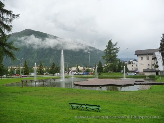
The "famous" Davos is also on our trail. In fact, in the suburbs of the village, we feel "its atmosphere" - we don't even have to open the windows.

ALPINE ROUTE – image 94

The town itself, apart from the fact that it is known, does not impress - and the area may look more interesting in winter, but it made a small interesting impression on us. If it is located on the route, you can take a peek, but to go there on purpose - it's not necessary.

ALPINE ROUTE – image 95

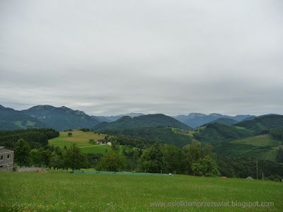
Heading west, we follow a picturesque route, unfortunately the weather is not good for us - but on a clear day, I think it is worth going this way.

ALPINE ROUTE – image 96

ALPINE ROUTE – image 97

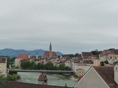
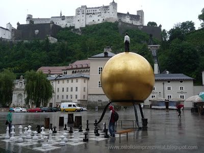
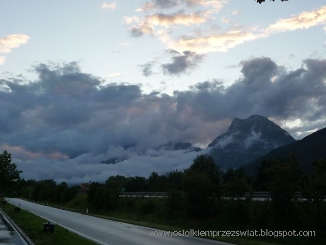
We reach the area where the three borders of Switzerland, Austria and Italy meet, and we have to decide which way to go next. After weather consultations, we decide to return to Austria. We spend the night in the vicinity of Innsbruck in the hope that the weather will be more favorable the next day.

ALPINE ROUTE – image 98

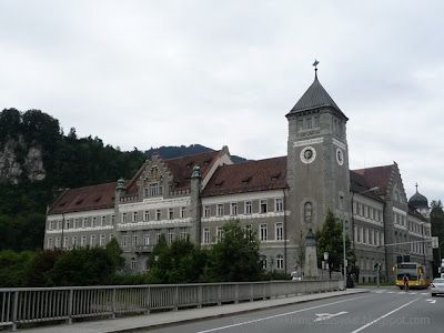
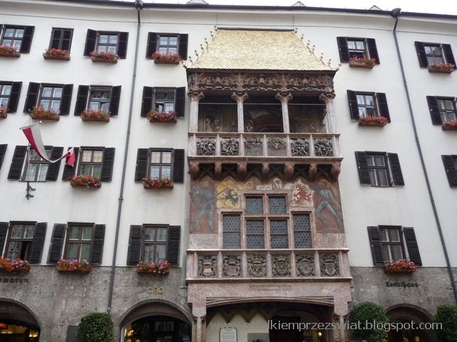
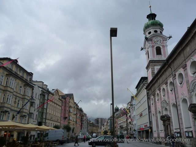
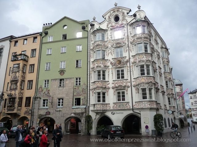
The capital of Tirol, Innsbruck, i.e. the bridge over the Inn River, is famous for its golden roof (a large bay covered with gilded tiles - 2,500). The monuments are concentrated mainly around the market square, and the negligible morning traffic allows you to delve into the local cobbled streets. Most of them are really narrow, so walking them allows you to feel the charm of this place.

ALPINE ROUTE – image 99

ALPINE ROUTE – image 100

ALPINE ROUTE – image 101

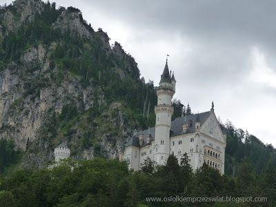
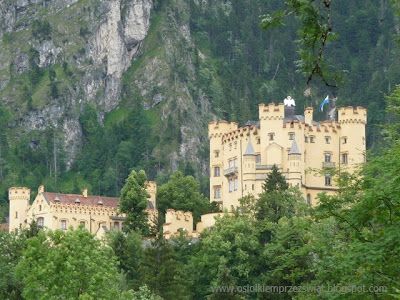
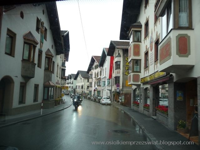
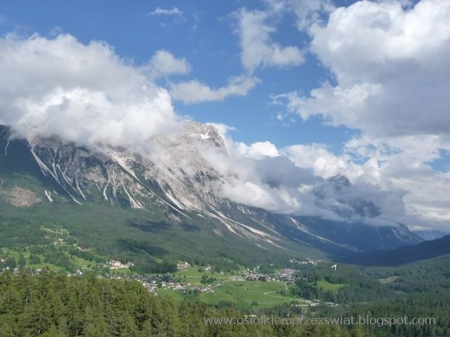
As the weather does not encourage visiting Austria, we decide to drop by the Dolomites for a while. We were there once, but some imp did not allow us to take pictures then - an imp, not an imp, or maybe it was meant to be back there again. From Innsbruck we follow the Brennenpass. However, we do not go on the highway, but we wander among alpine villages and towns.

ALPINE ROUTE – image 102

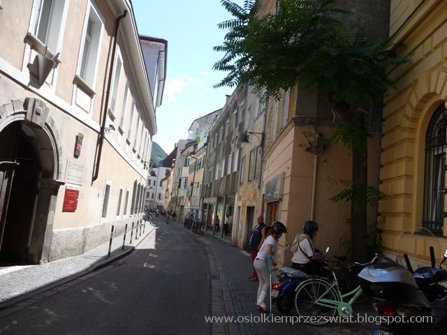
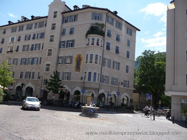
We cross the border and the moment what is there - suddenly beautiful sun, heat, even hot - yes, Italy. We visit Bolzano, a cultural mix - 25% of the inhabitants speak German. There are cafes and restaurants in the heart of the historic center in Piazza Walther.

ALPINE ROUTE – image 103

ALPINE ROUTE – image 104

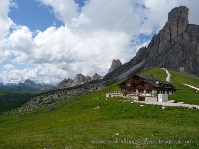
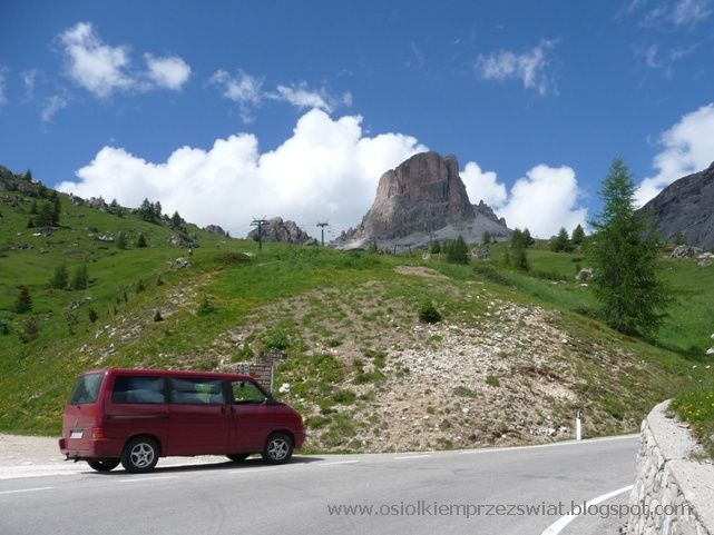
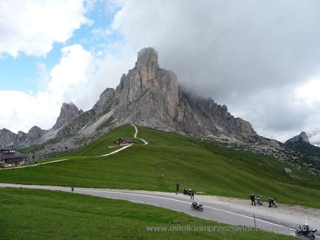
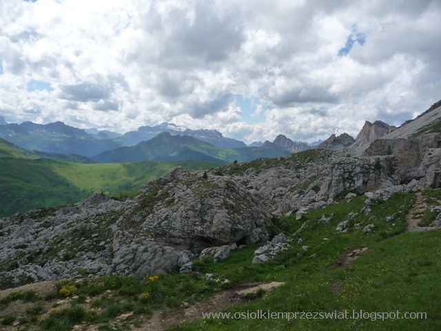
Direction Dolomites - the most beautiful mountains we know. How different from the typical alpine hills. We are going and seeing the first pointed peaks we are already looking forward to what will happen next. Az wants to spend a lot of time here - maybe someday we will go here for a typical holiday - unfortunately not now.

ALPINE ROUTE – image 105

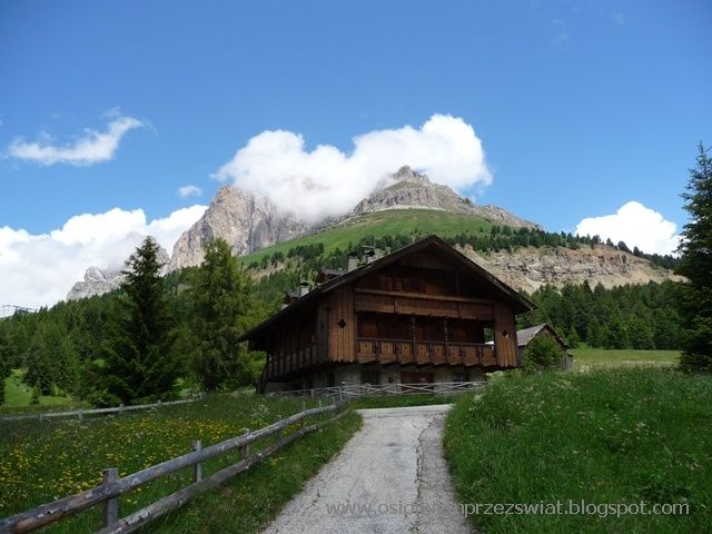
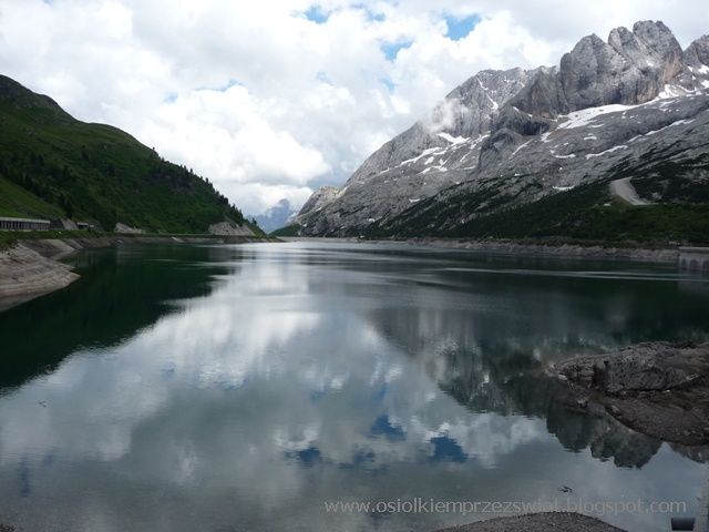
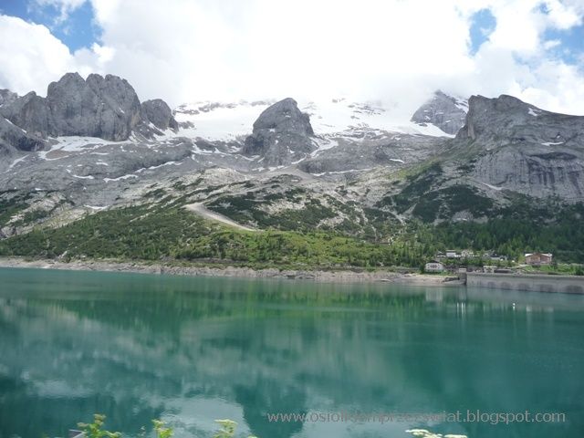
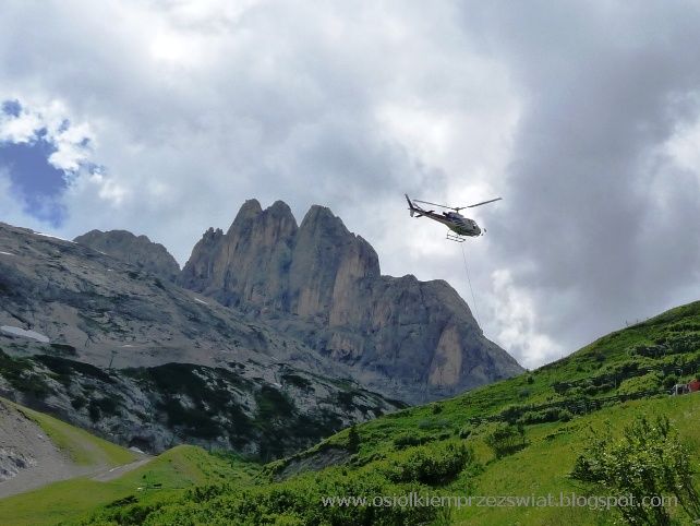
After Gries, we turn right into a side road. We stop in the vicinity of Marmolada - the highest peak of the Dolomites (3343). There is a parking lot with tables, from which you can take a look at the surrounding mountains. Unfortunately, there is also a disturbing sign - the prohibition of any camping and campering - which is a pity because the area is begging. Going further, passing the wonderful mountains, we reach an altitude of about 2000m above the Lago di Fadaia lake. Here, too, you can forget yourself watching the peaks of the surrounding mountains reflect in the turquoise waters. With a small car park, there is a restaurant and several shorter and longer hiking trails.

ALPINE ROUTE – image 106

ALPINE ROUTE – image 107

ALPINE ROUTE – image 108

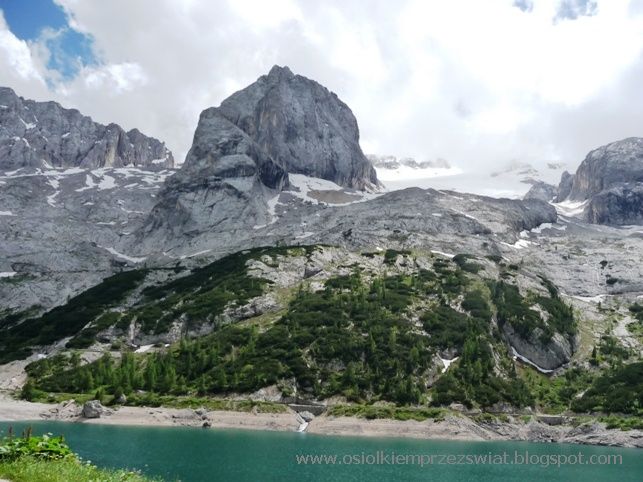
Behind the lake, a steep downhill ride begins - you have to be careful with the brakes, although the winding road, however, the distances between the bends allow you to really accelerate, which is not entirely advisable. We also have to wait a while because they are just sorting out the area by helicopter. Looking down the road looks innocent, but let's not get fooled by it - it has a lot of percent

ALPINE ROUTE – image 109

We get to the small town of Caprile from where we start our ascent to Passo di Giau - the most beautiful place where we have been. The driveway is quite long, but you can do it all the more because in several places it is possible to stop for a moment to cool down. We are getting closer, then again farther from the summit towering over the pass.
ALPINE ROUTE – image 110
A section begins from the parking lot, which must be overcome all the way to the pass in one go - there is nowhere to stand, but the views stretching from here encourage you to go higher and higher and still higher. With each corner we pass, we admire more and more - a donkey a little less. But we explain to him that there are wonderful views waiting for him upstairs and a loooong rest. Finally, we reach the longed-for pass, (2236) one of the favorite places of motorcyclists, of which there are crowds here both once and now. I am not surprised at all - the panorama is wonderful. We have a lot of time to admire it, although the clouds sometimes obscure the nearby peak.
ALPINE ROUTE – image 111
ALPINE ROUTE – image 112
ALPINE ROUTE – image 113

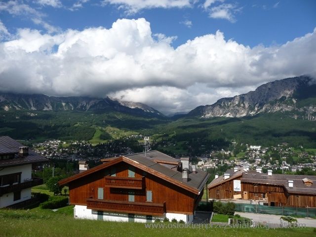
After lunch and afternoon coffee, only the descent to Cortina, and further along the alpine valleys, we approach the border with Austria - the weather is also so northern.

ALPINE ROUTE – image 114

ALPINE ROUTE – image 115

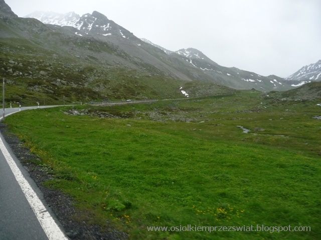
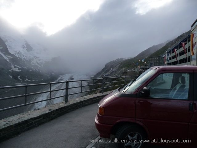
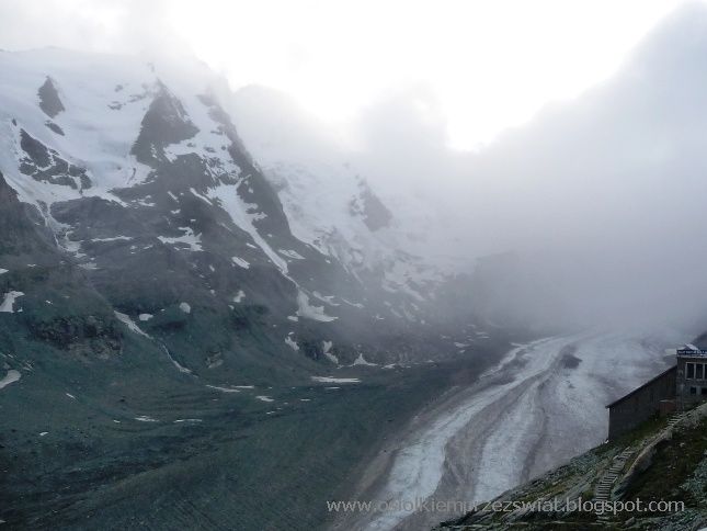
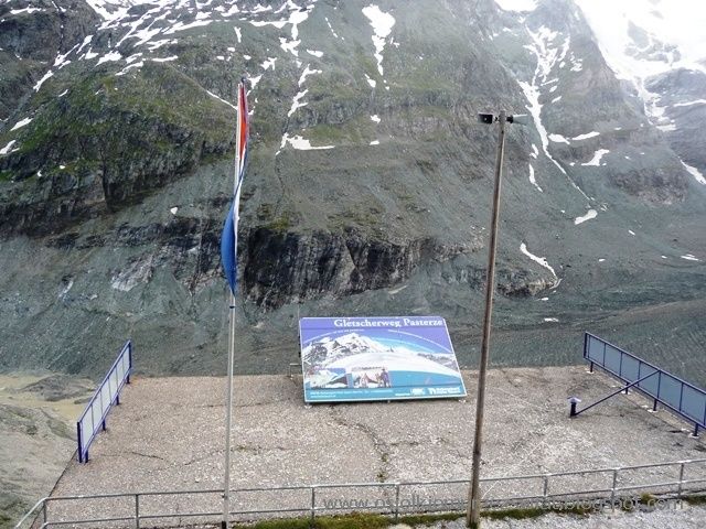
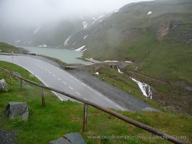
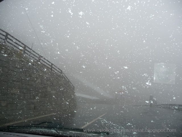
Well, the weather doesn't want to change too much - sometimes only the sun comes out. This is how it is when you leave sunny Italy. We are going towards the Hohe Tauern, where there are approx. 250 glaciers and over 300 peaks above 3000m with the highest Austrian peak Grossglockner (3797), 10 km with the Pasterze glacier, and the largest Krimm waterfalls (380m). roads in Austria. Unfortunately, it is payable and it is quite salty. At a length of 50 km, it covers 1750 m of elevation, so starting from an altitude of approx. 800 m, you drive through various climatic zones. At the toll collection points, you get a map with the indicated attractions, parking lots or restaurants and their descriptions. At first the road climbs the valley along gentle hills. Only after the toll collection point it rises more and more - we are practically alone on the road - sometimes a car will pass by, but because the weather is not too good, there is no vacation yet, so it's really a rarity. The higher it is, the worse it drizzles at first, then it pours all over.

ALPINE ROUTE – image 116

ALPINE ROUTE – image 117

At times it clears up and we manage to take some photos of Shepherds and the nearby peaks. There are also several suggestions for routes around the area next to the parking lot.

ALPINE ROUTE – image 118

The weather was very unfavorable for us - at one point it even started to snow, the temperature dropped to around zero and it was brrr. But on the other hand, it's good that it's so cold, because with these climbs 12-14% and the height, the donkey does not get tired so much.

ALPINE ROUTE – image 119

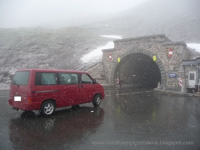
On the Hochtor Pass (2504m) it is raining down considerably. There is snow behind the tunnel - not only patches, but entire stretches - unfortunately we are in the clouds and not much else can be seen.

ALPINE ROUTE – image 120

ALPINE ROUTE – image 121

ALPINE ROUTE – image 122

Going down, we have numbered bends, and in the area there are a lot of grazing miles :)

ALPINE ROUTE – image 123

After leaving Grossglockner, turn on the GPS - direction home - navigation selects the highways, hence the daily mileage increases significantly. Just a short break somewhere on the road and this is the end of our alpine adventure - it's time to say hello to our gray reality again - just until summer.

frape
frape

The donkey puts hooves here and there…. he just travels the world. We travel in a small camper, if we can get there by car - we will get there, if not - we will try it on foot. Our trips are not boring, we have some more or less adventure almost every day. We get to know landscapes, monuments, people, and then we describe it on the blog with a pinch of humor ...

Also read