The Poor Journey - Norway / Poland part. 2/2
Time for the last part of the report from our trip this year. As we wrote in the penultimate part of the report The long route initiated a brainstorming to use the rest of the holiday and go somewhere for a few days.
We chose the Bieszczady Mountains in order to reach one of the peaks of the Crown of Polish Mountains - Tarnica, the whole plan has evolved so much that we decided to conquer all the peaks of the KGP in the Carpathians. After a quick stop at home, unloading unnecessary lumber, and a quick wash, we went to the east of Poland. The trip was delayed by a few hours, so we arrived there only around 10 pm. Daniel showed us the last wild and free camping site on the map, who travels the world in his Land Rover, it was a great alternative to our strained budget. :) However, finding this place in total darkness was not easy, because the entrance is nicely camouflaged between the bushes, but a nearby border guard patrol directed us a bit. On the spot, we found a few people sitting by the fire - former scouts. Without waiting long, we decided to make new friends and join the fire and fry long-awaited sausages. Initially, we were supposed to stay there only one day and move on, but the good weather and the proximity of the river meant that we stayed for about three days. The next day, we spent the whole day by the river, cooling our asses in the water. In the evening we prepared a dinner which hurt us a bit and we both had a sleepless night due to aching stomachs. In the morning we were exhausted and we were afraid to eat anything because we immediately felt like vomiting: (Around noon I improved and I decided not to waste the day hiking along the Otryt mountain range. Quite an interesting line - you can find many scales and remains from World War I because there was a front line on Otrita. After a dozen or so minutes of climbing on the way I pass the famous sociologist's hut and go to Trohaniec (939m above sea level), which is the highest elevation of the range. There is no tourist trail leading to the N peak, so I break through the grass on a narrow path which in addition is wet ... The top itself and the rest of the range are forested, so there is no way to admire the views :( At the top we find a cross with an inscription devoted to soldiers from World War I, covered with shells of ammunition and missiles from the On the way back, I stop by the Sociologist's Hut, if only for a moment, to see what it looks like, and I spent over an hour there talking to the inn. arzem. This place charmed me and I will gladly come back there in autumn or winter :) Unfortunately, it started to get dark and I had to interrupt our conversation and return to Dominika, who was resting during my absence, looking for interesting places to visit in August NG Traveler.
In the evening we made a fire and lay on the grass watching the stars that were remarkably visible thanks to the total darkness around. The next day, we lazed around the San again, but only until noon. Lying on the shore, a grass snake came to greet us - the only time and the only snake we saw during our entire stay. He was not eager to talk to us and pose so a moment later he swam on. In the afternoon we went for a walk around the area, finding various tracks reflected in the fresh mud. Hmmm, according to the information board with traces, our find did not match either a fox, a wolf or a marten ... they were probably traces of a lynx :)
Another west and another east strike the next day, so we slowly think about the further journey. In the morning we pack up and go to the Bieszczady National Park in order to reach the highest peak of the Bieszczady Mountains belonging to the Crown of Polish Mountains - Tarnica (1346 m above sea level). We planned an ambitious route, unfortunately there was a storm right after reaching the summit and we had to go a shorter way.
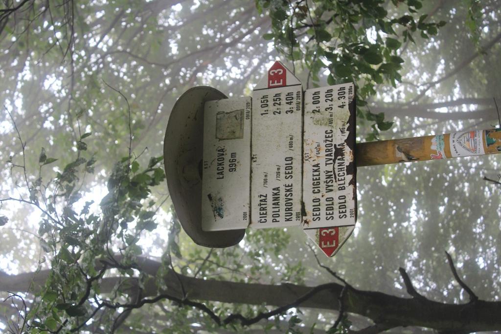
The rainy weather lasted until the evening, so we decided to move further along the Great Bieszczady Loop towards the Low Beskids to conquer Lackowa. Along the way, the clutch hit in the ass when we broke the bar in Norway ... it starts to slide quite a lot on the climbs, in addition, on the way we have a problem with finding a place to stay, the constant rain does not fill us with optimism, but in the end we pass a cove somewhere in the forest. Fast turning and we can finally go to sleep after a hard day. In the morning we continue our journey and reach the town of Izby, from where we start our journey to Lackowa. Unfortunately, we did not have a map of the Low Beskids, and the only information we knew was that you had to stop behind the stud farm in Izby and walk along the dirt road. The trail was very poorly marked, after about 1.5 km the first sign with the route marking, but the road forked and the signs did not indicate where to go. We walk, we walk, we walk, the signs are not visible, we walked about 5 km and we found ourselves in the village on the Slovak side: You cannot see a living soul, there is no one to ask for directions, we turn back and go back to the bus. Despite the lack of success, we do not let go! This time, out of laziness and saving time, we have already covered Tripim on a dirt road, despite the terrible mud and slippery clutch. On the way, we meet three tourists who are asked for directions. It turned out that at this fork you have to make a sharp turn by almost 180 degrees and enter the bushes, and the marking was a border post ... but the post was all overgrown, which along with the path was covered with tree trunks after the recent logging. By finding the trail, we are finally going in the right direction. We heard that despite its small height, Lackowa is difficult to climb, we didn't believe it until we climbed up the hill. The trail runs along a very steep slope, additionally, the rain and the mass of mud made the climb difficult, the fog limited our visibility to only a few dozen meters. After about an hour and a half hike, we reach the summit - Lackowa (997 m above sea level). Now another challenge awaits us ... as long as we managed to climb the mud, we have a problem with going down. It is easy to slide on your butt and even more so to get injured. Despite some dangerous skidding, we are at the bottom inches, a bit wet and covered in mud.
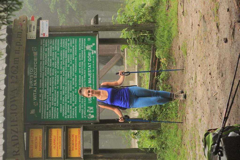
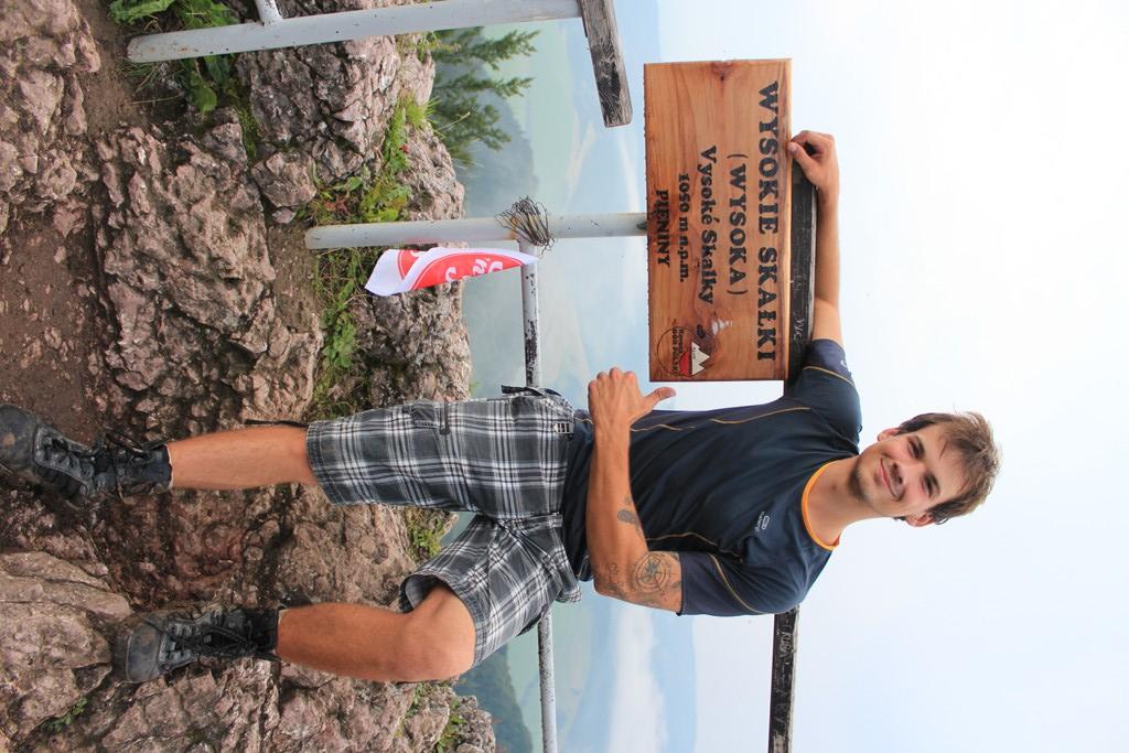
Another destination is the highest peak of Beskid Sądecki - Radziejów and the highest peak of the Pieniny Mountains - Wysoka. After analyzing the map, we come to the conclusion that it makes no sense to climb each mountain separately and we want to get them at once, thanks to which we will save over 80 km. We reach the town of Biała Woda, where we spend the night in the parking lot. In the morning, we map out the exact route and start the trek. On the way, we find whole glades of mushrooms, beautiful, healthy butterflies! Unfortunately, we do not have anything to take them to, anyway, they would have to be dried as soon as possible, and there are still more than 30 km ahead of us ... there are also boletes and boletes, which we take with us. After a few hours, we reach the top of Radziejowa ( 1262 m above sea level), where there is an observation tower, which we have just read about in Traveler. Supposedly, great views! We were not able to experience this. Rainy weather and clouds stopping at the tops of the mountains provide us only with a milky spectacle with a visibility of several meters. A quick meal, what would be the power and we are going further towards Wysoka. We choose a trail that is probably not traveled too often, in addition, a storm passed that way moments earlier, which means that we are splashing in the mud once again. The trip is arduous and difficult, we slowly start to get nervous, fatigue takes its toll, but finally we see a sign with the information that we have 15 minutes left to the summit. It takes us much and less and after a few minutes we reach the next peak of KGP - Wysoka (1050 m above sea level). At the top, we are attacked by red ants, so we take the photo and start descending. In addition, we have to run away from the next coming storm. We descend through the Homole gorge. On the way, we meet three shepherd dogs that looked dead. They didn't care at all about our presence, every now and then only their eyes opened ... I think they had a hard night watching the sheep. Fatigue is slowly taking its toll, especially when we have to walk the last two-kilometer stretch on the asphalt :) However, we do not give up, get in the car and drive towards Mogielica.
We spend the night on the Dunajec River, which after the last rainfall has turned into a brownish flowing, unpleasant for the eye, and even more so for a bath, so we can "take a shower" with wet wipes. We moved slowly towards Jurków, from where we went along the blue trail to the conquest of Mogielica. The trail, a little moderately marked, takes a moment not to pay attention and you can go elsewhere. Fortunately, we manage to enter without any problems. The trail leads a bit through the forest, then through the Cyrla clearing, where the hike is made more pleasant by beautiful views, and finishing again we enter the forest, where we only had to overcome a steep, rocky climb to reach the highest peak of the Beskid Wyspowy - Mogielica (1173m above sea level). up there is a dozen or so meters high observation tower, we hoped that maybe this time we would be able to see the Tatra Mountains. Hope was quickly lost, despite the beautiful weather, visibility was very poor. We had a view of only a dozen or so kilometers, the rest of the mountains were hidden behind a milky curtain; (Unfortunately, the summit itself did not impress us too much, everywhere was full of rubbish, despite the fact that we were in a nature reserve ... it's so hard for others to take papers with them and Going down the mountain, we went to see the papal cross, under which there is a granite plaque with the following inscription : "AGAINST THE BEAUTIFUL MOUNTAINS I FEEL THAT HE IS ... AND THEN I START TO PRAY" John Paul II. Karol Wojtyła on the hiking trails of the Beskid Wyspowy On the 50th anniversary of his stay in Mogielica, August 22, 2004.
Coming back to the trail, we talked so much that by accident we started descending along the green trail, which resulted in another quick 10-minute ascent to get back to the blue trail. But I guess it was a poor lesson and while we were marching through the clearing and probably talking about some nonsense, we crossed a fork, where we were supposed to turn, of course, and we didn't ... after a while we found ourselves in the forest. We didn't want to go back again, so after a quick spin of the map, we decided to go down through the forest until we entered the trail again. In the evening we went to the Czorsztyńskie Lake, where our good friends of Multimata and Michał and Monika spent the weekend. We spent the evening together by the fire, but the moment came when we left our girlfriends and the male part of the team got on the boat and went to catch dinner. Only Multimatiem was lucky, as he won the zander, but it was enough for everyone :) After Mati prepared the catch, we unanimously stated that it was the best fish we have ever eaten !!! On the day after tomorrow we went to quickly reach the nearby peak - Turbacz. At first, we wanted to make it easier for ourselves by taking two Alaskans from Michał and Monika, which effectively pulled us uphill (it was worse when going downhill because it was continuous downhill), but we forgot that Turbacz is located in the Gorce National Park and after paying attention to the ban on the introduction of animals, we did not want to risk a fine, so we had to bring them back. After the quick action, we found ourselves on the trail again and, without saying much, we found ourselves first in the shelter, where we stamped the booklets, and then we climbed the real peak 5 minutes away from the shelter. Our collection of prey includes the 9th peak - Turbacz (1310m above sea level). After returning, we eat delicious roasted dishes prepared by Monika and Jadzia. Unfortunately, the saddest moment of the whole trip is coming - the vacation is ending and the time to return home; (On the way back we wanted to climb Lubomir and Rysy, but unfortunately we did not have enough time ... and even that and good, because we have a reason to organize another a trip to these beautiful regions.
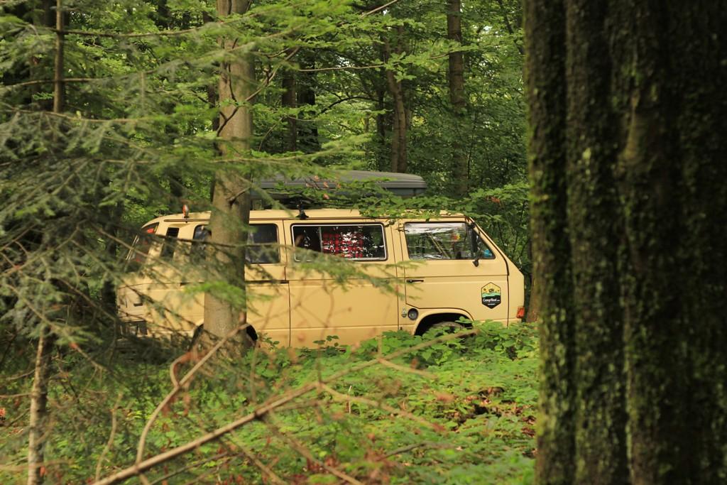

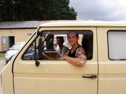
We are two students of Tourism and Recreation at AWF Katowice who want to visit the deepest corners of the world. Our teaser and passion for adventurous journeys, combined with Bartek's childhood dream from childhood, resulted in the purchase of an old school square - Tripciak :) The idea to buy a bus and tour the whole world was born when little Bartuś, who was only 5 years old, saw the cult fairy tale for the first time Scooby Doo and their crew in the crazy The Mystery Machine ... additionally infected with a travel note from an early age. From that moment, he started dreaming about his own bus, where he will be able to visit the whole world, getting to know foreign cultures, people, curiosities and secrets that the world hides;) Finally, after 16 years of dreams, he managed to buy a worn VW T3, which served almost 20 years as German ambulance - becoming the apple of his eye. After stormy deliberations, together with his chosen one, they named him Tripciak gloBus! We also invite you to our blog: http://tripciakglobus.blogspot.com/